




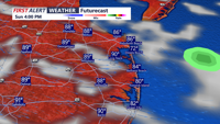
A cold front will sweep through Delmarva this afternoon, helping to break the heat.
From
To

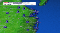
Sussex County’s beach communities will stay cool Tuesday before a milder Tuesday night into early Wednesday as southerly flow develops.

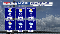
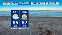
High pressure slides to the east on Saturday, allowing for warmer conditions with increasing clouds. Even warmer on Sunday with more clouds and breezy conditions.

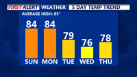
Delmarva will enjoy sunshine and warmer temperatures Saturday, partly cloudy Sunday with an isolated chance for showers and thunderstorms arrive Sunday night with an approaching cold front. Another front moves through Tuesday, setting up cooler, drier weather midweek.

DELMARVA -- High pressure shifts to the south and east of Delmarva on Monday afternoon, setting up a return flow that will help push temperatu…


A shift to a southerly flow will bring warmer temperatures and mostly dry conditions to Delmarva on Monday and Tuesday, with highs reaching the low to mid-70s before a weak cold front approaches midweek.

A ridge of high pressure will keep Delmarva dry and mild through Monday, with warmer temperatures on the way as a southerly flow develops. Highs will reach the low to mid-60s, making for a pleasant start to the week, but changes are ahead with a cold front arriving midweek.

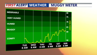
A primary cold front will approach the Delmarva Peninsula on Saturday, bringing warmer and muggier conditions by the afternoon as the flow turns southerly. Expect high temperatures in the low to mid-80s with mainly dry weather during the day, but showers and thunderstorms are likely after 8 PM as the front moves in. Additional unsettled weather is anticipated from Sunday with a marginal risk for severe storms. High pressure will bring drier conditions for the first half of the upcoming week.

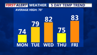
Delmarva will experience a cooler and comfortable day today, with temperatures reaching the 70s across the region. Winds will remain gusty, adding to the crisp September-like feel. The cool, dry weather will continue into tonight with clear skies and light winds, setting the stage for another cool night. Gradual warming is expected as we approach the weekend, with high pressure dominating and temperatures climbing back into the 80s by Friday.

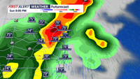
Delmarva will experience a dynamic weather pattern from tonight through Tuesday, with multiple rounds of showers and thunderstorms as a warm front and cold front move through the region. Heavy rainfall, strong storms, and the potential for localized flooding are expected, especially on Sunday. Cooler temperatures will follow on Monday and Tuesday as fronts push offshore, bringing a welcome break from the humid conditions.