


DELMARVA- A few lingering showers are still possible this afternoon. They'll be isolated into the evening hours then ending. Highs will only be in the 60s to near 70 this afternoon. It will feel cooler with gusty west winds up to 25 mph.
Overnight expect mostly clear skies with lows in the upper 40s and lower 50s.
Despite the breezy start, fair weather will generally prevail through the weekend. With cooler air aloft lingering in the region, cumulus cloud development is likely both Saturday and Sunday, though coverage should be less extensive by the end of the weekend.
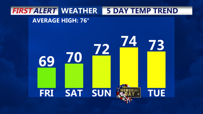
Saturday and Sunday will feature a mix of sun and clouds, with temperatures running a little below average. Highs each day will be in the low to mid 70s, with lows at night in the upper 40s to lower 50s.

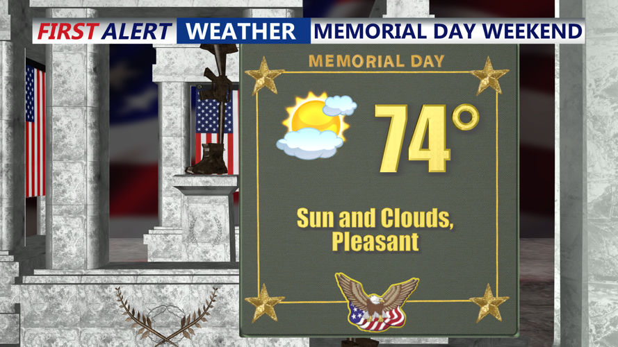
Looking at a mix of sun and clouds with highs in the 70s Memorial Day.
Memorial Day is shaping up to be dry with a mix of sun and clouds and temperatures in the low to mid 70s. With surface high pressure continuing to build southeastward from the Great Lakes. A more stable mid-level flow is expected to keep precipitation well to the south. While a few weather models suggest the possibility of rain brushing southern Delaware, the prevailing setup favors dry conditions across the Delmarva Peninsula.

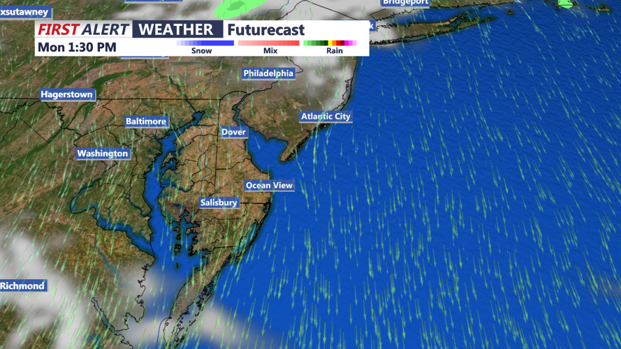
Rain chances should remain low through Tuesday, before our next system rolls in midweek.
Winds may turn lighter by afternoon, allowing for localized sea or bay breezes to develop. High temperatures are forecast to reach the low to mid-70s inland, with slightly cooler readings along the coast.
As the week progresses, conditions begin to shift. Mid-level ridging Tuesday may help extend dry weather briefly, but increased cloud cover and a more onshore low-level flow will lead to cooler and more humid conditions.
By late Tuesday and into Wednesday, moisture may surge northward as low pressure tracks from the Tennessee Valley into the Ohio Valley, with another system potentially forming near the Carolina coast. This may result in scattered showers developing across Delmarva, though much of the heavier precipitation may remain south of the region.
Wednesday is likely to be cooler, thanks to persistent cloud cover and onshore winds.

