


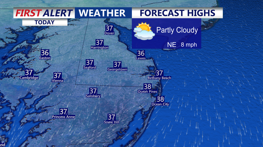


DELMARVA -- The peninsula is firmly in the grip of winter this week, with temperatures running 5 to 10 degrees below average. Today, skies will range from partly sunny to mostly cloudy, and highs will range from 33 to the north and 42 to the south.

Partly sunny skies and highs in the mid to upper 30s, staying dry.
As evening arrives, calm winds and clearer skies will allow temperatures to fall sharply, with lows between 15 and 24 degrees. Thankfully, wind chills won't be a major factor tonight due to the lack of significant wind.

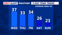
Temperatures crash into the weekend back into the 20s.
Thursday brings a bright but colder day. Despite mostly sunny skies, temperatures will remain in the lower 30s, continuing the below-normal trend that will persist through the end of the week.
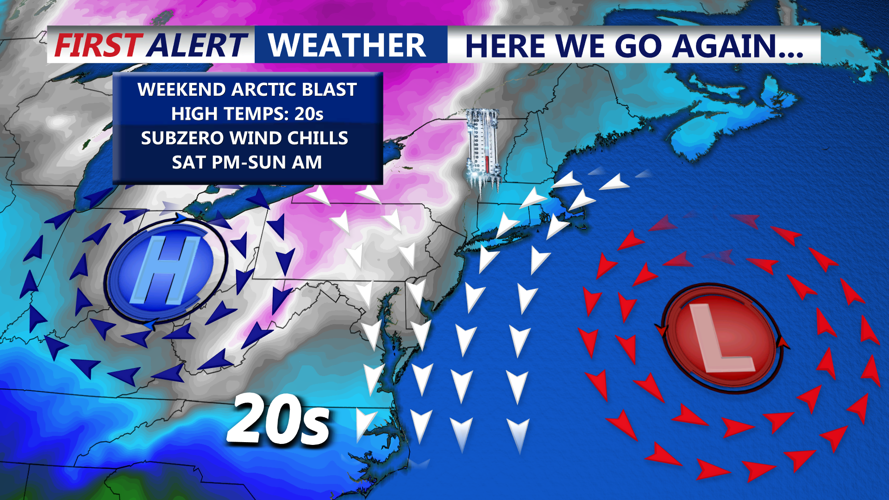
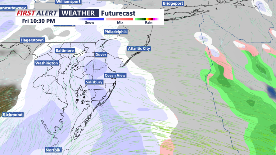
The quiet, chilly pattern will come to a head Friday night as an arctic cold front barrels through the region. This strong front, tied to a clipper system tracking across southern Canada, will bring two possible rounds of snow to Delmarva.

Arctic front pushing through Friday night will bring a chance of light snow and snow squalls.
The first round of snow may develop during the day on Friday as warm air overruns the colder surface air ahead of the front. Accumulations are expected to be light, with many areas seeing just a coating to perhaps half an inch.
The second round is more impactful and arrives with the cold front itself late Friday night into early Saturday morning. Along this boundary, snow squalls are possible — brief but intense bursts of snow that can drastically reduce visibility and quickly cover roads. Confidence in snow squall development is still limited, but the setup includes strong atmospheric energy and favorable forcing, both of which support the potential.
Behind the front, winds will ramp up dramatically. Northwest wind gusts of 40 to 50 mph are likely Saturday afternoon and evening, possibly even stronger near the coast. This will usher in dangerously cold subzero wind chills across the region through Saturday night and Sunday. We could have wind chills values as low as -10 to -5 below.
Temperatures may moderate slightly by the middle of next week, but the bitter cold and active pattern will make for a challenging stretch of winter weather across Delmarva.