


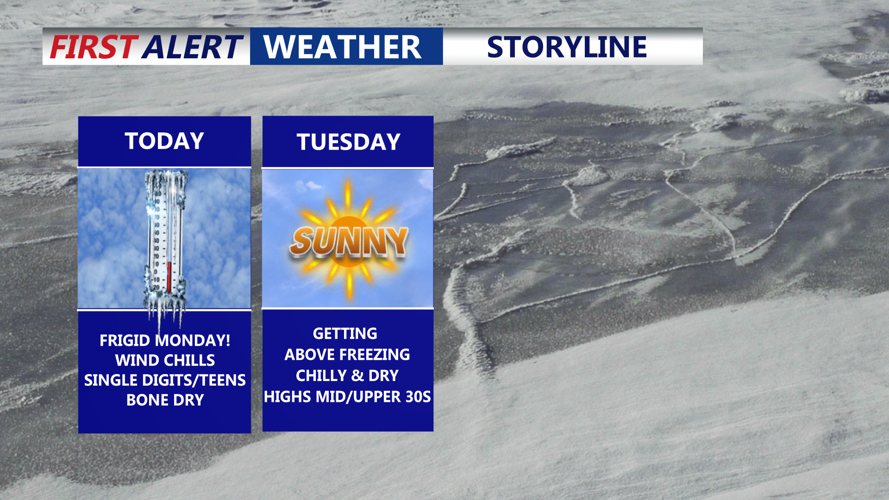


DELMARVA - High pressure continues to build into Delmarva today, keeping Arctic air firmly in place as cloud cover gradually increases. Despite diminishing winds, lingering gusts of up to 20 to 25 mph remain possible, especially early, keeping wind chills in the teens and 20s. With recent snowfall and increasing clouds, temperatures will struggle to climb, topping out in the mid-20s to low 30s across the region.

Winds won't be a huge factor this evening through the overnight.
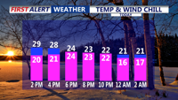
Another cold night follows tonight as skies partially clear and winds ease. Lows will fall into the teens for many areas, with wind chills also in the teens before daybreak Tuesday.

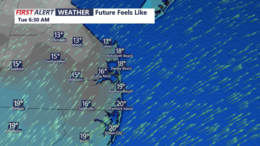
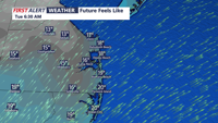
Wind chills Tuesday morning will be in the TEENS for most areas on the peninsula.
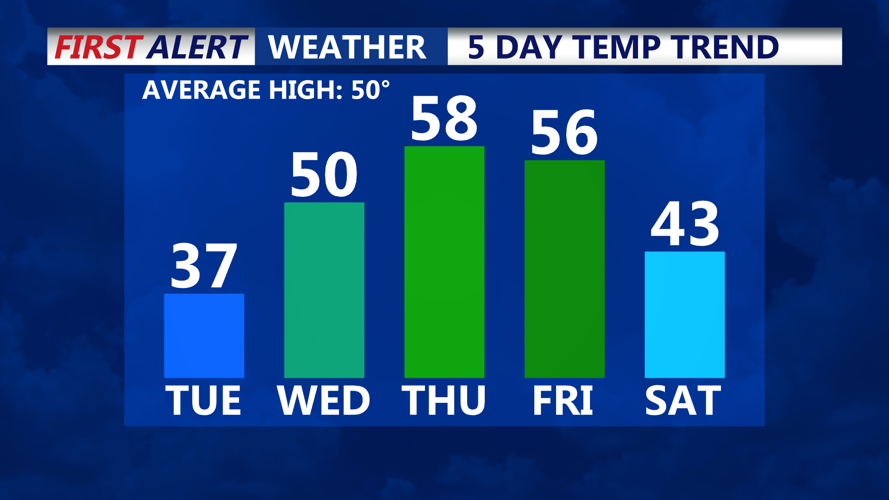
By Tuesday, the center of high pressure shifts south of the region, allowing southwesterly winds to develop. This brings a modest warmup, with highs climbing into the upper 30s to near 40. Sunshine early will give way to increasing clouds late in the day as a weak upper-level disturbance approaches. Tuesday night turns colder again, with clearing skies allowing temperatures to drop back into the 20s and teens.

Slowly turning milder Tuesday and pushing to near 60 degrees by Thursday ahead of a cold front.
Clouds return Wednesday as a weak front approaches from the northwest, though no precipitation is expected. Southwesterly flow helps boost highs into the upper 40s to low 50s for most of Delmarva. A weak high settles in Wednesday night, keeping lows mainly in the 20s.
A stronger warmup arrives Thursday as southerly winds strengthen ahead of the next system. Highs are expected to reach the mid to upper 50s, with some locations nearing 60 — shaping up to be the warmest day in weeks. Clouds increase ahead of a cold front that brings rain and gusty winds Thursday night into early Friday.
Behind the front, colder air returns Friday with highs back in the 40s. High pressure builds in for the weekend, bringing colder nights and a mix of sun and clouds Saturday. Another system may bring rain late Saturday night into Sunday, along with slightly milder temperatures to close out the weekend.