


Back-door front may cool Sussex Saturday
-
pwilliams
Chief Meteorologist
Paul Williams has earned ASSOCIATED PRESS CHESAPEAKE BAY BEST WEATHER ANCHOR/METEOROLOLOGIST 2019, 2021, 2023, and serves as the chief meteorologist at CoastTV, delivering weather forecasts during the 5, 6, and 11 p.m. broadcasts. As a key member of the Draper Media storm tracker weather team, he provides crucial emergency weather information to help safeguard the community.

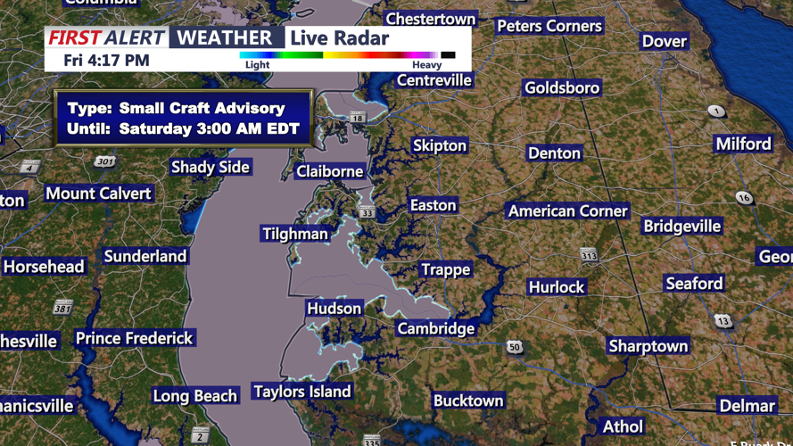
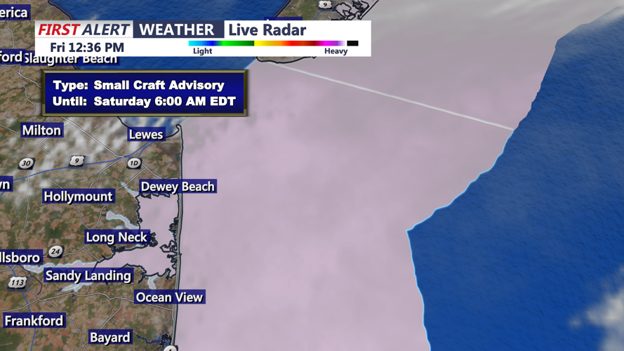
SMALL CRAFT ADVISORY - CAMBRIDGE
pwilliams
Chief Meteorologist
Paul Williams has earned ASSOCIATED PRESS CHESAPEAKE BAY BEST WEATHER ANCHOR/METEOROLOLOGIST 2019, 2021, 2023, and serves as the chief meteorologist at CoastTV, delivering weather forecasts during the 5, 6, and 11 p.m. broadcasts. As a key member of the Draper Media storm tracker weather team, he provides crucial emergency weather information to help safeguard the community.