


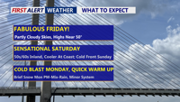
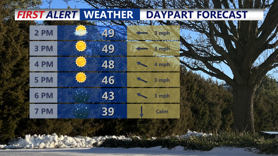


DELMARVA -- It's a beautiful finish to the workweek after a wild start with our blizzard. Today features partly cloudy skies with afternoon highs climbing into the upper 40s to low 50s.

Mostly sunny skies with highs around 46-52 on Delmarva, clear night falling back into the upper 20s/low 30s. Some patchy fog into Sat morning.
Tonight turns mainly clear and colder, with lows dropping into the upper 20s to low 30s. With clear skies and light winds, a little patchy fog is possible around daybreak Saturday.
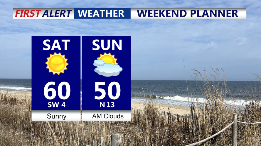
Saturday brings the warmest air of the weekend. Expect mostly sunny skies with inland highs pushing to around 60. If you’re heading to the coast, plan on a cooler afternoon at the beaches, where temperatures hold in the 40s and 50s thanks to the ocean influence.

Beautiful weekend in store, Saturday the pick of the weekend as we make a run at the low 60s.
Late Saturday night into Sunday, an arctic front slides through Delmarva. Behind it, Sunday turns noticeably colder with an increasing northerly breeze and clouds decreasing through the day. Highs will top out in the upper 40s to around 50, but the breeze will make it feel cooler.
Looking ahead to Monday through midweek, the pattern becomes more active and colder air will be in place. Arctic high pressure building over the Northeast keeps Delmarva cold Monday into Tuesday, while a couple of separate systems may pass near the region.
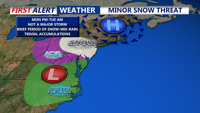
The first system arrives Monday into Monday evening. Right now, it looks like weak low pressure tracks near the Chesapeake region but stays mostly suppressed to the south. That keeps precipitation chances on the lower side, with only a 20–40% chance of light snow later Monday. Any accumulations appear limited at this time, and recent trends have been lower. Snow will change to a mix then rain into Tuesday.

An area of low pressure will spread a period of light snow into the area Monday evening, snow is expected to change to mix and rain, minimal accumulations area expected at this time.
A second disturbance could follow late Tuesday into Wednesday. Confidence is higher that this one brings precipitation, with chances increasing into the 50–70% range. As temperatures begin to moderate Tuesday into Tuesday night and a southerly flow develops, a rain/snow mix could start things off before changing to plain rain by Tuesday night.
After the early-week chill and any wintry rounds, the end of next week looks noticeably milder. Forecast highs trend back into the 50s and 60s late next week into next weekend, signaling a significant warm-up for Delmarva. Looking at the long range, we could potentially see 70s by the second week of March.
