


DELMARVA -- Putting a bow on a picture-perfect weekend, it's been quite a start to the month of August. Every single day has been below average.

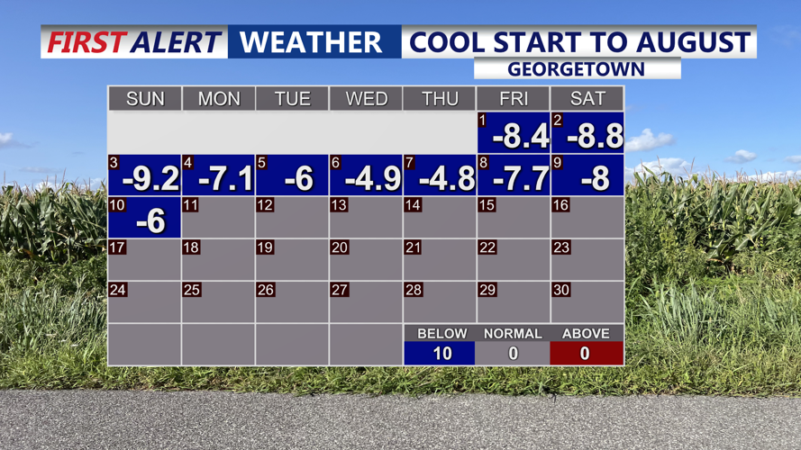
We have been below average everyday in Georgetown to start the month.
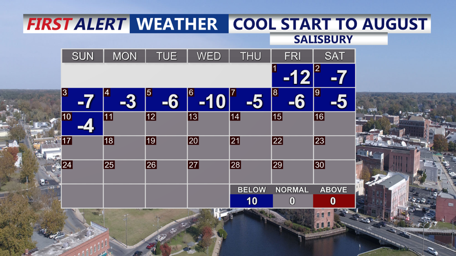
Here's a look at our two climate sites Georgetown and Salisbury, each day shows the departure from the normal high temperatures. Salisbury is off to one of it's coolest August's ever.

Below average everyday this month in Salisbury, one of the coolest in history.
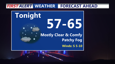
Sunday night will feature another clear and cool night as temperatures dip into the upper 50s inland and the 60s along the coast. Patchy fog could develop overnight into Monday morning, especially in low-lying areas, but it should quickly dissipate after daybreak.

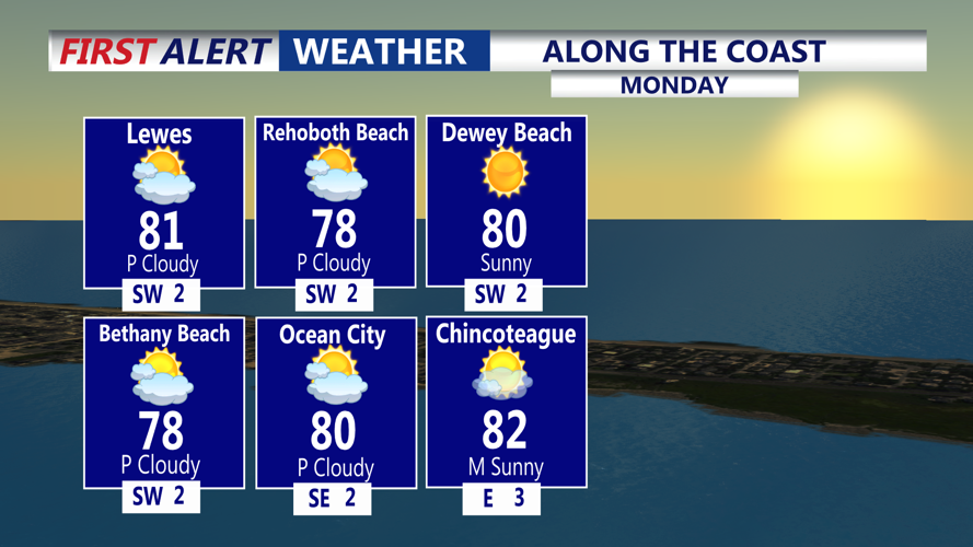
Another beautiful day on Monday with highs in the upper 70s to low 80s. MODERATE rip current risk for the DE Beaches.
High pressure over the region will keep conditions dry and comfortable to start the week, though it will gradually weaken and shift east through Tuesday. Monday will bring mostly sunny skies and pleasant temperatures in the mid to upper 80s, with slightly warmer readings inland. MODERATE rip current risk for the DE Beaches, while a LOW rip current risk for Ocean City to Chincoteague.

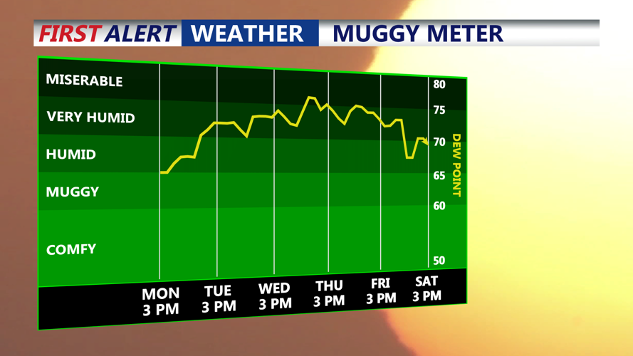
Turns muggy Tuesday and very humid Wednesday and Thursday.
By Tuesday, a very warm to hot air mass will settle in ahead of an approaching cold front. Highs are expected to climb into the upper 80s to low 90s, cooler along the coast. Dew points in the 60s to low 70s may drop slightly during peak heating, keeping heat index values below advisory levels.

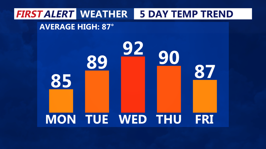
Temperatures back into the 90s by midweek, feeling like 100 with the humidity on Wednesday.
Wednesday could see increased humidity and a chance for isolated afternoon storms as a surface trough develops across the area. Temperatures will remain hot, with many inland spots reaching the low 90s and heat index values near 100 degrees in urban areas.
A cold front will arrive from the northwest Thursday into Friday, possibly stalling over the region into the weekend. Chances for showers or thunderstorms are low—only around 20 to 30 percent—any storms that develop could briefly interrupt the otherwise warm and mostly dry stretch.
Looking ahead to next weekend, slightly lower humidity is possible if high pressure builds in from the north, but temperatures will stay on the toasty side for mid-August.