


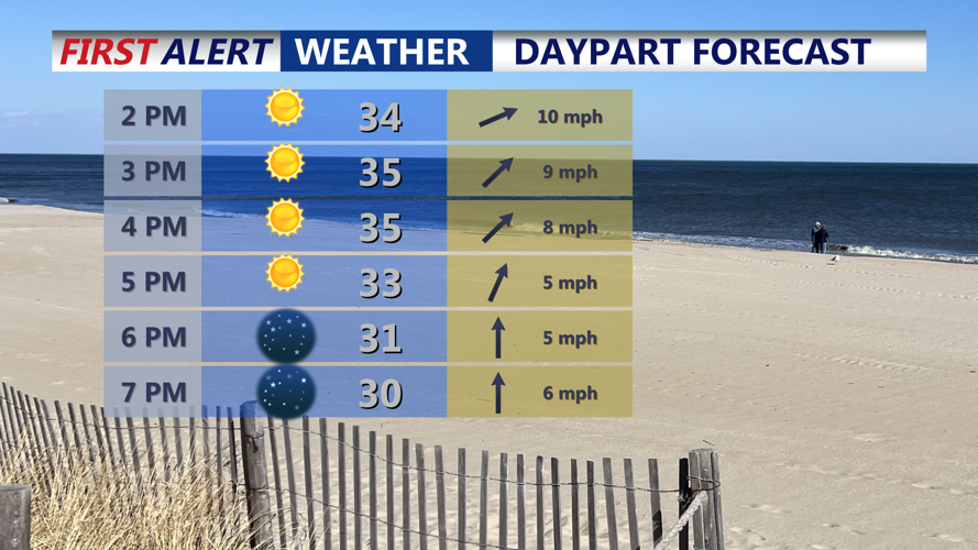


DELMARVA -- After wind chills in the teens early today, skies stay bright and sunny across Delmarva as temperatures climb into the mid- to upper 30s and near 40, with west-southwest winds 10 to 20 mph. Clouds increase tonight, with lows dipping into the upper 20s to low 30s.

Sunny skies, highs in the mid to upper 30s, wind chills in the upper 20s.
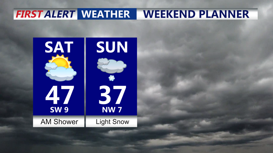
A series of disturbances moves in late tonight into Saturday. The first arrives in the pre-dawn hours, with a few light rain showers possible around midday Saturday across much of the peninsula. Northern Delmarva could briefly see snow showers, while Sussex County trends mainly rain. Despite the passing showers, Saturday looks slightly milder, with highs 45 to 50 under partly sunny skies and south-southwest winds 10 to 20 mph.

Brief midday shower possible, snow shower northern Delmarva, watching the coast for a round of light snow late Sunday.
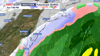
The weekend’s main question mark comes Sunday as a coastal low develops near the Outer Banks and tracks northeast offshore. The overall threat for significant snowfall on Delmarva remains low, with most guidance keeping the storm far enough out to sea for only light snow—mainly near the coast.

Coastal low will track to our southeast Sunday spreading a period of light snow into the peninsula late afternoon-evening.
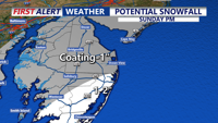
In Sussex County, especially along the beaches, a light accumulation is possible, with around a half-inch to 1.5 inches favored near the immediate coast and less inland, as much as 2 to 3 inches southern portions of the peninsula, Ocean City, Assateague Island, Chincoteague. Precipitation exits Sunday night.

Most of the area will see a coating to an 1", highest totals likely from Ocean City on southward where 1" to 2" could fall into Sunday night.
Behind that system, a deep eastern U.S. trough ushers in an arctic airmass. Dry weather is expected, but several days of below-normal temperatures set in from Sunday into the middle of next week. The coldest stretch looks to be Monday night through Tuesday night, when wind chills could drop into the single digits. Tuesday currently appears to be the coldest day, with highs projected in the mid to upper 20s. Some moderation may begin late next week as the trough starts to lift.