


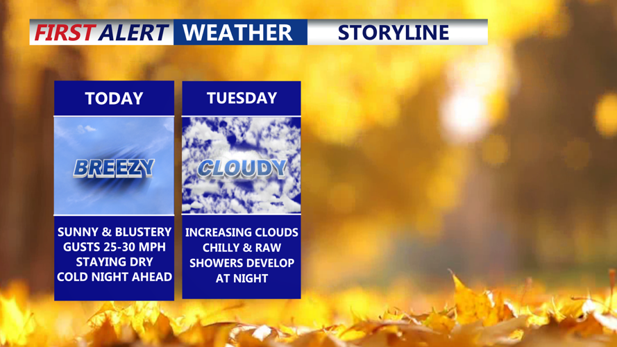


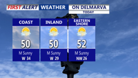


DELMARVA -- A brisk and sunny day is on tap across Delmarva today as strong low pressure pulls away into the Canadian Maritimes. Temperatures will run below normal, with highs only in the upper 40s to low 50s.

Mostly sunny brisk day on the peninsula with highs in the upper 40s to low 50s.
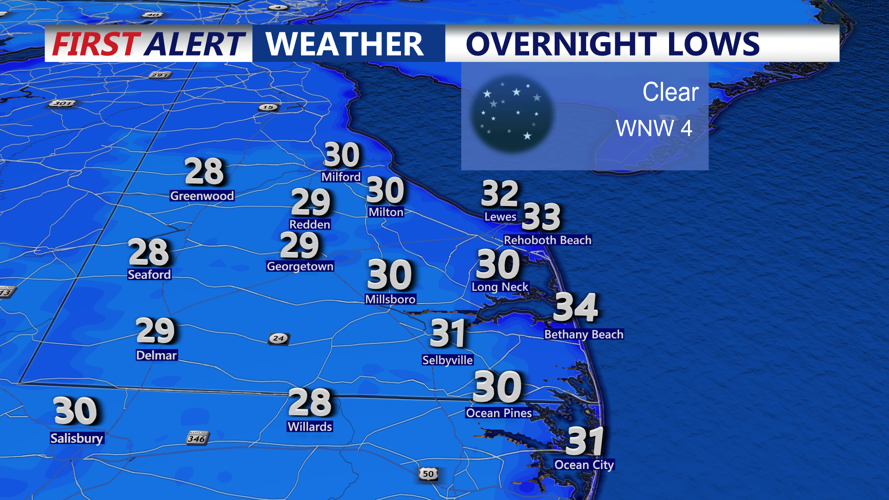
Winds will gust out of the northwest 30-35 mph. Clear skies and diminishing winds tonight may allow for radiational cooling in outlying areas, sending overnight lows into the upper 20s to low 30s, slightly warmer along the coast.

Clear skies and calm winds will allow temperatures to fall into the upper 20s away from the beaches into Tuesday morning.
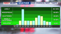
A cold air mass remains in place Tuesday as high pressure builds toward the region. Highs will again reach the upper 40s to low 50s. Clouds increase through the afternoon as a weak low tracks east from the Ohio Valley. Showers develop after sunset and sweep quickly across the peninsula, delivering between a third and half an inch of rain by early Wednesday.

Showers move in Tuesday night-Wednesday morning, another chance of rain late Friday-Saturday.
Precipitation ends early Wednesday, but clouds linger for much of the day. Highs will reach the low 50s under mostly cloudy skies.
From Thursday into the weekend, conditions trend milder overall with limited chances for rain. A piece of upper-level energy may trigger a few showers Thursday, though most areas stay dry. Highs will range from the 40s to mid-50s. A warm front lifts north Thursday night into Friday, followed by a weak cold front Friday night. Ahead of it, temperatures climb into the mid-50s to mid-60s Friday with the best chance for rain occurring later Friday into Friday night.
Another cold front may cross the region Saturday or Saturday night, though the timing remains uncertain. High pressure gradually settles in from the west on Sunday, bringing drier conditions to end the weekend.