


DELMARVA - We can expect a chilly and breezy day as high pressure approaches from the west while a broad trough lingers over the region. Variable cloud cover will dominate, with areas near the coast likely seeing the most sunshine. Northern and western parts of the area, such as the Lehigh Valley, southern Poconos, and northwest New Jersey, may experience scattered flurries or snow showers as shortwave energy rotates through in the afternoon.
Winds will range from 10 mph to occasional gusts of 20 to 25 mph, adding to the brisk conditions. High temperatures are forecasted to remain in the upper 30s to low 40s, with colder readings in the low to mid-30s over the southern Poconos and northwest New Jersey.
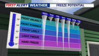
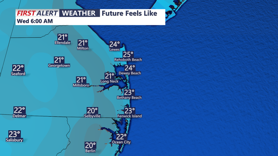
Tonight, skies will clear, and temperatures will drop sharply as surface ridging builds over the area. Expect lows by Wednesday morning to dip into the low to mid-20s.
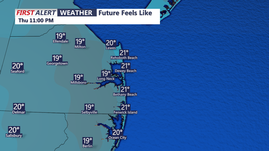
A strong storm system is poised to affect Delmarva Wednesday night through Thursday night. The system is expected to bring rain and snow showers, strong winds, and continued below-normal temperatures. A strengthening low-pressure system will sweep a cold front through the region on Thursday morning, with winds increasing as temperatures plummet. Post-frontal conditions will feature strong cold air advection, with temperatures at 850 mb dropping to -10 to -15°C.
Residents should prepare for rapidly changing weather conditions and stay updated as this storm system approaches.