


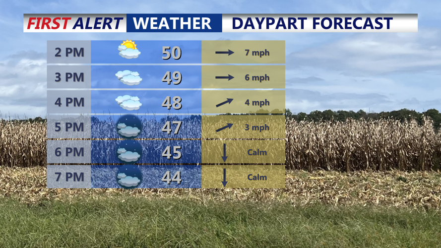


DELMARVA -- After a cold start in the twenties, temperatures will rebound into the upper 40s to low 50s on Delmarva. Clouds will steadily increase through the afternoon as a weak surface low tracks toward the region.

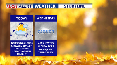
Increasing clouds, highs around 50s, showers develop this evening, steadiest rain will be overnight into Wednesday morning.
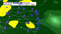
By late tonight, warm air and moisture arriving from the southwest will help develop a chilly rain across much of Delmarva. Areas farther north may see the shield of precipitation arrive a bit later, but most locations should receive steady overnight rainfall.

Steady widespread rain on the peninsula through Wednesday morning.
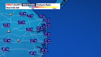
Rain tapers quickly after daybreak, leaving behind stubborn cloud cover thanks to lingering moisture and a light northerly wind. Highs will again reach the upper 40s to low 50s. Rainfall totals from the overnight system are expected to average 0.30–0.50 inches, with isolated pockets nearing 0.75 inches.

On average a half of an inch of rain with as much as three quarters of an inch in some localized spots.
Wednesday night remains mostly cloudy as high pressure to the north nudges closer. Some drizzle may develop, where a lingering boundary sits overhead. Overnight lows will dip into the upper 30s to near 40 degrees.
Cloudy skies continue with spotty drizzle possible, but measurable precipitation chances remain low—generally under 15 percent. Highs will stay on the cool side, ranging from the low to mid-50s.
By Thursday night, warmer air begins to lift north ahead of the next system, keeping lows above freezing—from the mid–upper 30s north to the low–mid 40s south.
A frontal system associated with an upper-level trough brings periods of light rain Friday into early Saturday. Highs climb into the 50s and even low 60s as Delmarva briefly enters the warm sector ahead of the cold front.
Rainfall amounts appear light, and timing differences between models mean scattered periods of rain—but most of Delmarva should see at least some precipitation between Friday morning and Saturday morning.
A secondary front may move through late Saturday. Most of the weekend trends drier, but another weak disturbance could deliver light rain to southern areas later Saturday or Saturday night. Confidence in this is low.
High pressure builds in, bringing dry, seasonable weather to start next week.