


DELMARVA -- A gradual change in the weather pattern is underway across the Delmarva Peninsula as weakening low pressure moves offshore today. This shift will bring a clearing trend from northwest to southeast, ending any lingering fog or drizzle.

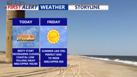
Skies clearing this afternoon into the evening with highs in the mid to upper 70s.
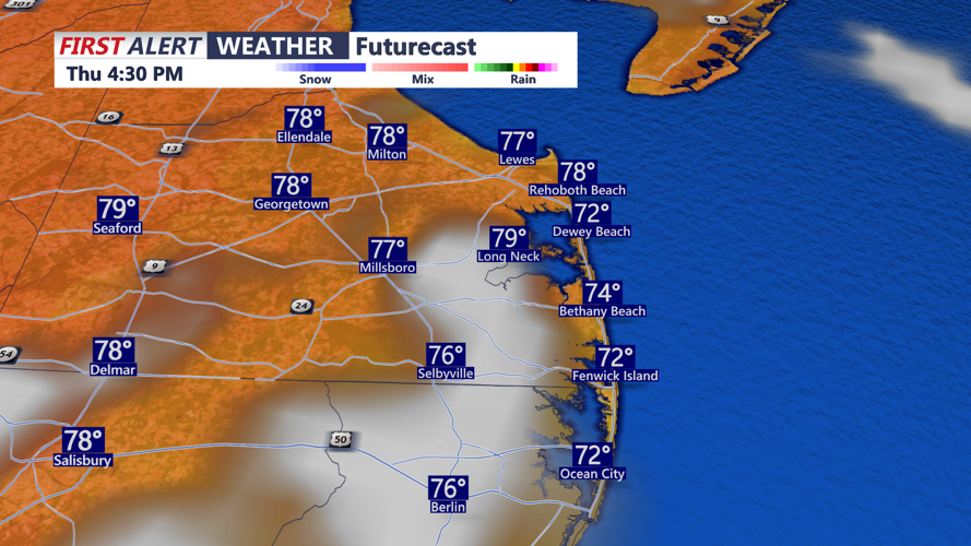
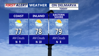
Most of the region will see partly to mostly sunny skies this afternoon. Highs are forecast to reach the mid to upper 70s inland, with a few spots on the mid-shore and in Kent County, Del., potentially climbing to 80 degrees. Winds will be light from the west to northwest at 5 to 8 mph, turning more southerly near the coast later in the day due to a sea breeze.

Clearing skies through this afternoon as temperatures rise into the mid to upper 70s.
Tonight will be mainly clear and cool with lows dropping into the upper 50s to low 60s. Patchy fog may develop overnight in some locations.

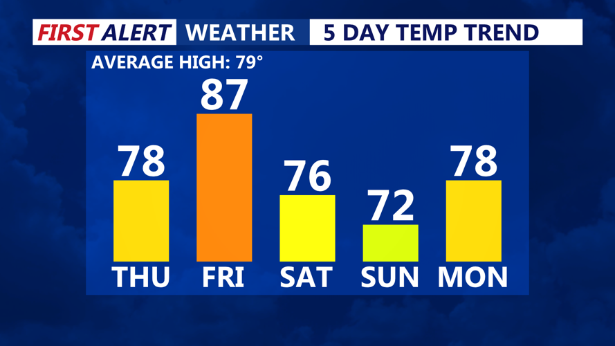
Summer-like temperatures return Friday, weak cold front pushes through late Friday.
Friday will feature warm and sunny conditions across the region. Afternoon highs are expected to reach the mid to upper 80s away from the coast, while a sea breeze keeps immediate shoreline temperatures cooler. Dew points in the low 60s will help keep humidity at manageable levels. A dry cold front will pass through the area Friday night, accompanied by scattered clouds and a shift to northeast winds. Low temperatures Friday night will range from the low to mid 60s.
Canadian high pressure will build into New England on Saturday, bringing notably cooler weather. Easterly onshore winds and increasing cloud cover are expected, with highs holding in the mid to upper 70s. Cloud cover will thicken Saturday night due to an impinging marine layer.
Sunday will be the coolest day of the forecast period as marine-layer clouds persist under the influence of the Canadian high pressure system. Most of Delmarva will stay dry, but a few showers are possible near a stalled frontal boundary. Highs will range from the low to mid 70s with lows Sunday night in the 50s to low 60s.
Looking ahead to early next week, high pressure will slide offshore, allowing for moderating temperatures and a return of southerly winds. Highs will climb back to near 80 degrees Monday and into the low to mid 80s Tuesday and Wednesday. Most of the area will stay dry, though isolated showers could develop by late week.
