




DELMARVA - Wednesday starts under mostly cloudy skies as a frontal boundary settles south of the area, bringing cooler and more stable conditions compared with Tuesday.
Northeasterly winds will dominate through much of the day, keeping temperatures lower and limiting the amount of instability available for thunderstorms. While much of Wednesday could remain dry, an approaching upper-level disturbance may provide enough lift to produce scattered showers and thunderstorms, especially during the afternoon and evening.
The atmosphere near the ground is expected to remain relatively stable, which should reduce the threat for widespread severe storms. However, some instability higher in the atmosphere could still support thunderstorms capable of producing brief heavy rain, lightning and locally gusty winds.
Any showers and storms that develop Wednesday evening should gradually weaken overnight. Mostly cloudy conditions may linger into early Thursday morning as the frontal boundary begins lifting back north.
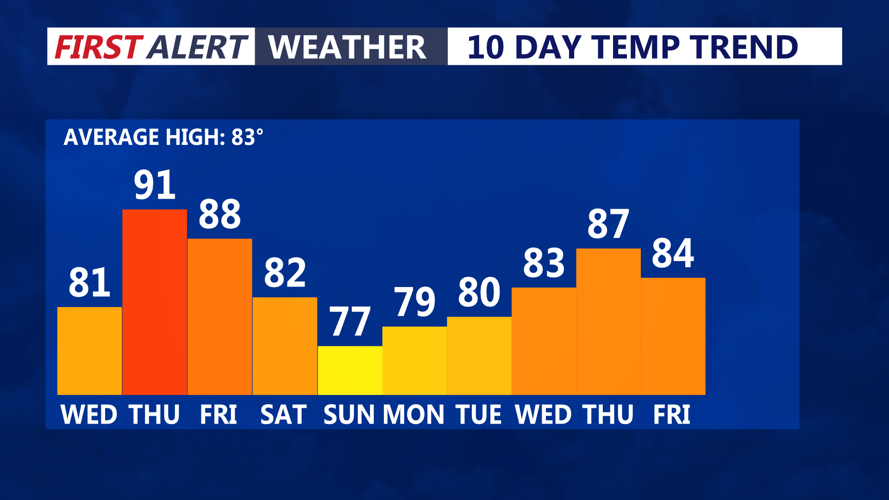
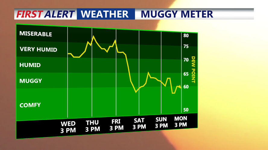
Humidity will start increasing again late Wednesday night into Thursday morning. Temperatures will also begin trending upward as warmer air returns to Delmarva.
