


DELMARVA -- High pressure will maintain its grip on the Delmarva region through Tuesday, keeping conditions mostly dry and temperatures seasonably warm. A weak cold front is expected to pass through Tuesday night, followed by a stretch of cooler, breezy weather and a calm early fall weekend.

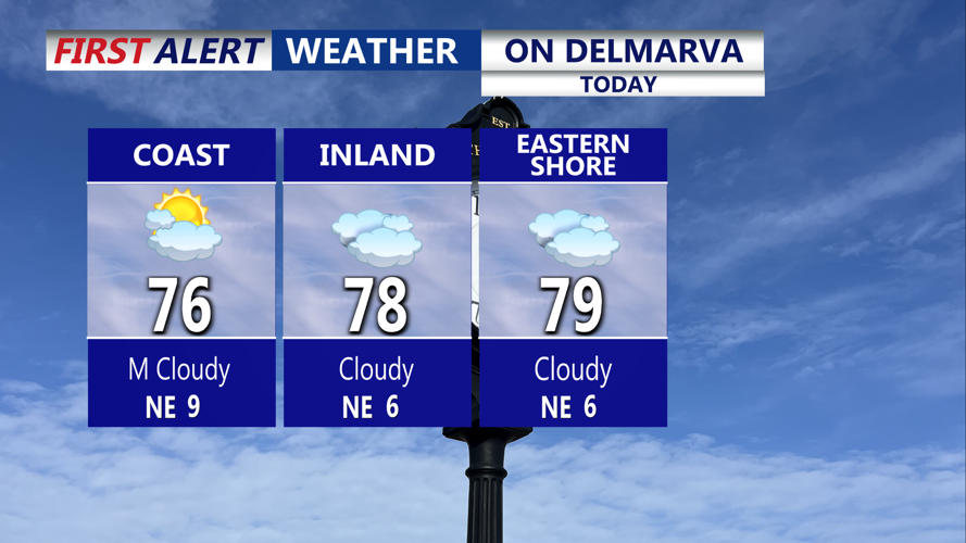
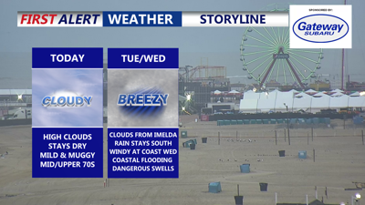
Cloudy mild muggy Monday with highs in the mid to upper 70s.
Increasing high clouds are expected throughout the day, with highs reaching the mid- to upper 70s, approaching 80 in some areas. Isolated shower is possible southern Delmarva. Lows Monday night will dip into the upper 50s to low 60s under partly cloudy skies.
On Tuesday, high pressure will retreat south ahead of an approaching cold front, with an upper-level trough sagging across the Mid-Atlantic. Mostly cloudy skies will dominate, but no rain is expected. Temperatures will remain mild with highs in the mid- to upper 70s.
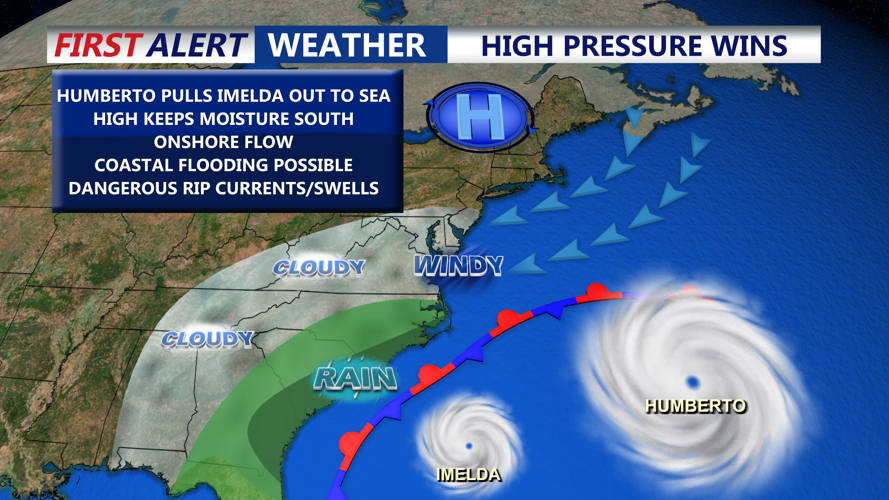
Major Hurricane Humberto and Tropical Storm Imelda will stay to our south and no major impacts are expected. Humberto will pull Imelda out to sea late Tuesday through Wednesday.

Hurricane Humberto tracks out to sea and because the storm is strong and close to Imelda, will pull Imelda out to sea late Tuesday-Wednesday.
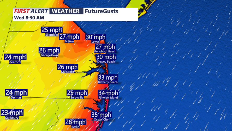
Dangerous surf conditions develop starting Tuesday and lasting through Friday. Waves between 5 and 9 feet and strong rip currents are forecast, with northeast winds gusting up to 30 to 35 mph along the coast. Coastal flooding is possible during Wednesday’s high tide cycles.
The cold front will move through Delmarva Tuesday night, ushering in a fall-like airmass. Lows will fall into the mid- to upper 50s.
By Wednesday, high pressure will begin building in from the north, bringing cooler air and brisk northeast winds. Gusts could approach 40 mph at the coast with lighter winds inland.

Northeast winds pick up late Tuesday into Wednesday, gusts 30-40 MPH, strong onshore push could lead to coastal flooding during high tide cycle Wednesday.
Skies should be mostly sunny with highs only reaching the upper 60s to low 70s. Wednesday night will be quiet, with lows in the upper 40s to low 50s under mostly clear skies.
The weather will turn even more tranquil later in the week. Large-scale upper-level ridging will establish itself Thursday and continue through the weekend, keeping conditions dry and gradually warming. Thursday will remain breezy, with highs in the upper 60s. Dew points in the 40s and 50s. By Friday and through the weekend, high pressure will settle overhead, weakening winds and allowing temperatures to moderate. Highs are forecast to climb into the upper 70s by Sunday.
