


DELMARVA - Cold northwest flow will persist across Sussex County late Sunday evening as strong low pressure moves farther into the Canadian Maritimes. Winds gradually ease from earlier highs but remain brisk, with gusts around twenty miles per hour continuing overnight. A few lingering sprinkles or flurries may hold on through the first part of the evening before fading. Overnight lows will drop into the upper twenties to low thirties, and wind chills will make conditions feel even colder, dipping into the teens and twenties.
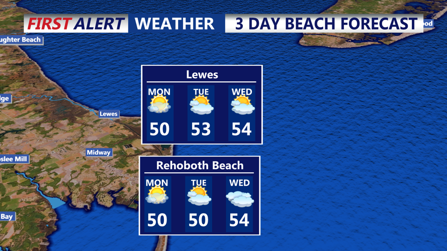
By Monday morning, dry air remains firmly in place. Skies will stay mostly clear to partly cloudy as high pressure approaches from the south. Winds will be less intense than Sunday but still capable of gusting twenty to thirty miles per hour during the afternoon. High temperatures will reach the mid-to-upper forties across much of Sussex County.
Monday evening brings continued cold air and diminishing winds as high pressure settles closer to the Mid-Atlantic. Temperatures will fall back into the thirties after sunset under mostly clear skies.