


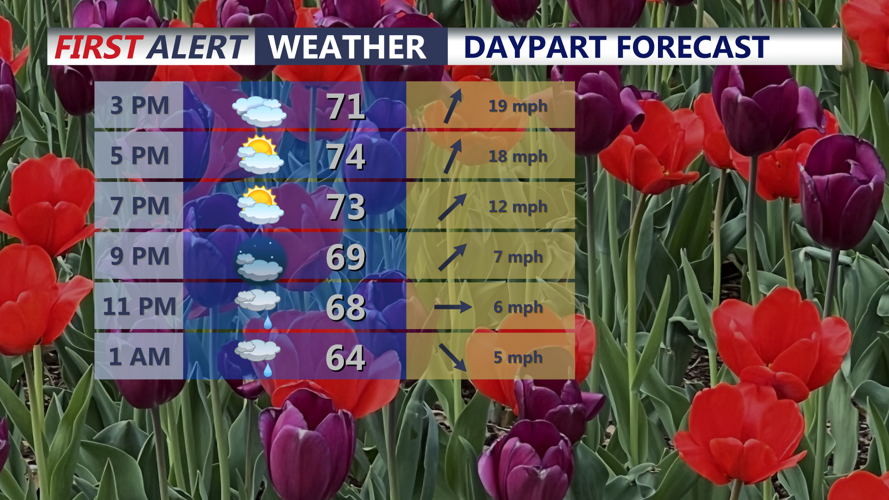


DELMARVA -- Changes arriving today, mostly cloudy skies with a few showers this afternoon as a cold front approaches the region. Conditions will be mild and breezy, with highs reaching the low to mid 70s. Southwest winds will be gusty through the day, with gusts as high as 35 to 40 mph.

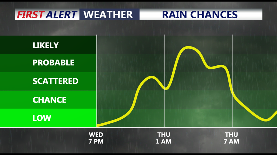
Mostly cloudy skies and highs in the mid 70s, another round of showers develops late this evening into Thursday. Wind gusts 35-40 mph.
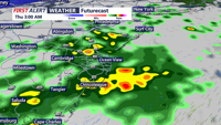
A few showers may develop early this afternoon, though most of the day is expected to remain dry. The better chance for showers arrives late this evening and continues into Thursday morning as the front moves through Delmarva.

Cold front pushes through tonight bringing scattered showers and an isolated thunderstorm.
Tonight, temperatures will fall into the low 50s with scattered showers possible. A brief downpour cannot be ruled out. As the front crosses the area this evening, there may also be an isolated low-topped thunderstorm, especially across portions of Delmarva. Severe weather is not expected.

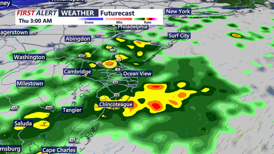
Rainfall totals through midday Thursday, 0.30"-0.50" with some higher amounts in southern areas.
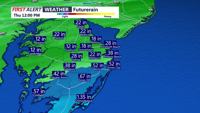
The front will gradually sag south and east overnight, keeping some showers possible, though rainfall is not expected to be significant. Forecast rainfall totals for today and Thursday generally range from around 0.20" to 0.50", with locally higher amounts possible farther south, especially in Worcester, Somerset, and Accomack counties. Son not quite drought busting.
Additional light rain may linger into Thursday morning as a wave of low pressure develops along the front near or just south of Delmarva. Recent trends have shifted this system and its rainfall farther south, which may limit impacts locally. Thursday will be cooler, with highs generally in the 60s.
High pressure briefly returns Friday, bringing a quieter stretch before more unsettled weather develops over the weekend. Additional rounds of low pressure could bring rain chances Saturday and again later Sunday. At this time, these systems look more like weekend nuisances than major impacts.
Temperatures will stay cooler late this week before a warming trend develops over the weekend. Highs Saturday will generally be in the 60s to low 70s, while Mother's Day looks warmer with highs in the 70s to near 80.
Another chance for widespread rain moves in Sunday night through Monday.
