


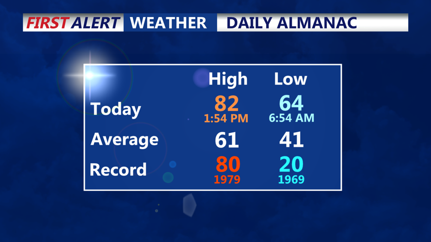


DELMARVA - Near-record warmth in Sussex County is expected to give way late Wednesday as a cold front pushes through, bringing showers and thunderstorms that could become severe during the evening hours.
The main threat with any stronger storms will be damaging wind gusts, though isolated hail is also possible. The risk is higher across Delmarva, which includes Sussex County, as the front moves through Wednesday evening into the night. Showers may linger after the front passes, with rain coverage gradually decreasing overnight. Lows are expected to remain in the 50s across Delmarva.
By Thursday, cooler air is expected to spread into the region behind the front, but Sussex County could sit close to where the boundary stalls. That means temperatures may vary widely depending on the front’s exact position, with some parts of Delaware potentially reaching the 60s or even near 70 while cooler air holds elsewhere. Late Thursday evening is expected to remain unsettled mainly because of that nearby stalled boundary, though the more significant storm threat should be over by then.
