


DELMARVA - Low pressure and a strong cold front are set to move across Sussex County and the broader Delmarva Peninsula Sunday evening into early Monday, ending the recent mild stretch and ushering in a much colder, windy start to the workweek.
The main round of rain is expected to arrive between roughly 8 p.m. and 11 p.m. from southwest to northeast, as the primary low and its cold front sweep through. Expect another band of showers, with a low chance for an isolated thunderstorm mainly over the southern Delmarva, but the better storm environment remains south of the region. Rainfall totals of about one-tenth to one-quarter of an inch, with locally higher amounts, are possible overnight.
As the front passes, winds will shift from south-southwest to northwest, increasing overnight with gusts that could reach 20 to 30 mph, especially along the coast and over the higher bridges and overpasses. Temperatures, warm early in the night, will drop into the 40s by daybreak, with colder readings possible inland.
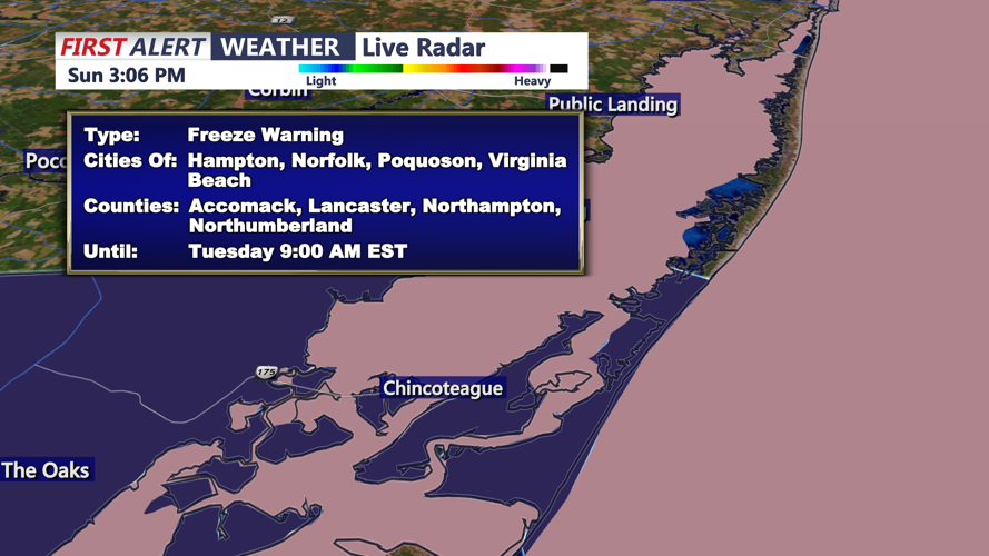
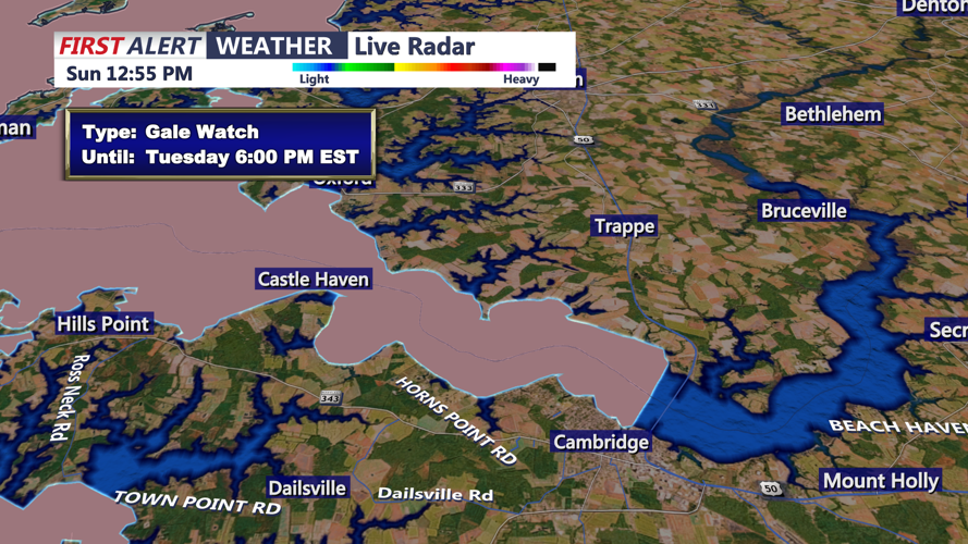
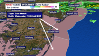
As of Sunday afternoon, no widespread severe weather watches or warnings were posted for Sussex County, though marine zones just offshore and portions of the Mid-Atlantic coast are dealing with small craft and gale headlines as the system strengthens over the coastal waters. A general Hazardous Weather Outlook highlights the risk of gusty post-frontal winds and a sharp temperature drop behind the front. Residents should continue to monitor the latest alerts from the National Weather Service and local emergency officials.
By Monday morning, the cold front will be off the coast and the low will be lifting into New England. Any lingering showers should taper off shortly after sunrise, giving way to mostly cloudy, brisk conditions. Behind the front, a deep upper-level trough will drive in modified arctic air, making Monday feel more like December than November. Highs across Delmarva are expected to reach only the mid-40s to low-50s, with northwest winds 15 to 25 mph and higher gusts. That will push wind chills into the 20s and 30s, especially by late afternoon.
The coldest stretch arrives Monday night into early Tuesday, when skies partially clear and the cold air settles in. Lows are forecast to drop below freezing across most inland areas, with only the immediate coast possibly staying just above 32 degrees. Wind chills are expected to fall into the teens and 20s, prompting concerns for anyone out early Tuesday and for sensitive plants or unprotected pipes.
Looking ahead, high pressure centered near the Gulf Coast will slowly build in through Tuesday, allowing winds to gradually ease while temperatures remain cool. Another, weaker cold front is forecast to cross the Mid-Atlantic later Wednesday, keeping conditions a few degrees below average but with limited chances for additional precipitation. High pressure then rebuilds over the region late in the week, bringing mainly dry but seasonably cool weather into next weekend.
Residents across Sussex County and the Delmarva Peninsula should be prepared for wet roads and reduced visibility during the Sunday night commute, followed by much colder, windy conditions for the Monday morning drive. Officials advise securing light outdoor objects, checking on vulnerable neighbors, and dressing in layers for the first true shot of early-winter air.
