


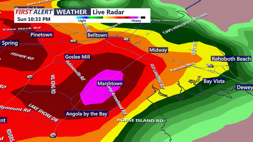


DELMARVA - The latest thunderstorms have raced quickly across our region at 50mph to the north east. The majority of the most intense cells continue to primarily target Kent and New Castle Counties; however, intense downpours have created pockets of blocked visibility due to quick downpours. Tune into Coast TV after the football game for the latest tracking of the storms.
From late Sunday evening into the overnight hours, a band of showers will move west to east across Delmarva as low pressure and its cold front cross the region. The steadiest rain is expected roughly 8 p.m. to 2 a.m., with rain amounts generally a tenth to a quarter of an inch, and locally higher pockets where showers briefly become heavier.
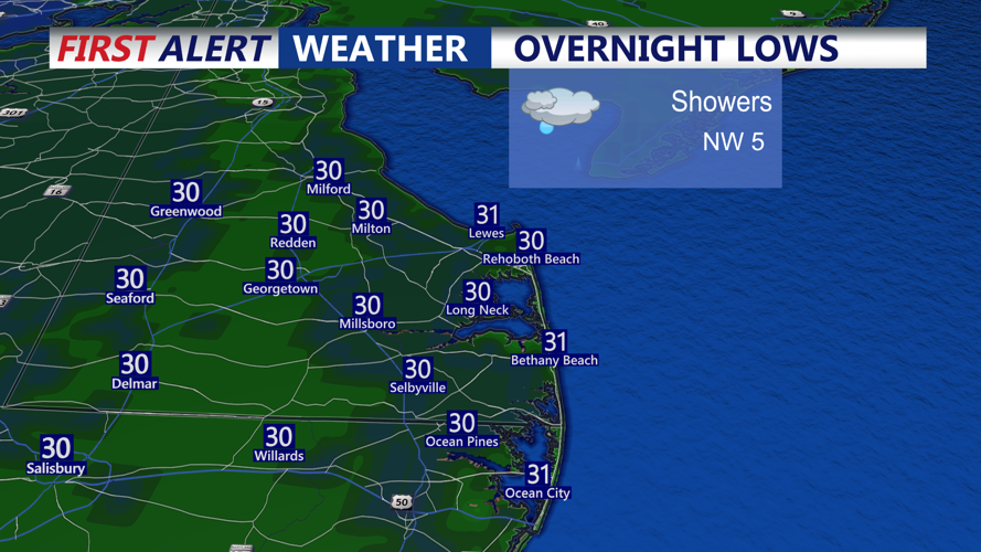
Allow for an isolated thunderstorm mainly over southern Delmarva, but the stronger storm environment remains well to the south, so organized severe weather is not expected. Skies remain mostly cloudy, and temperatures that start in the upper 50s to low 60s during the evening will fall into the 40s toward daybreak behind the front.
Winds will shift quickly to the northwest after the front passes, increasing overnight with gusts in the 20–30 mph range, strongest near the coast and over higher bridges and causeways. That may make travel a bit more difficult for high-profile vehicles late Sunday night and early Monday.
Monday: raw, windy and much colder
By Monday morning, the cold front will be east of the area and the low will be lifting into New England. Any lingering light showers should end shortly after daybreak, with most of Sussex County and Delmarva turning dry but mostly cloudy.
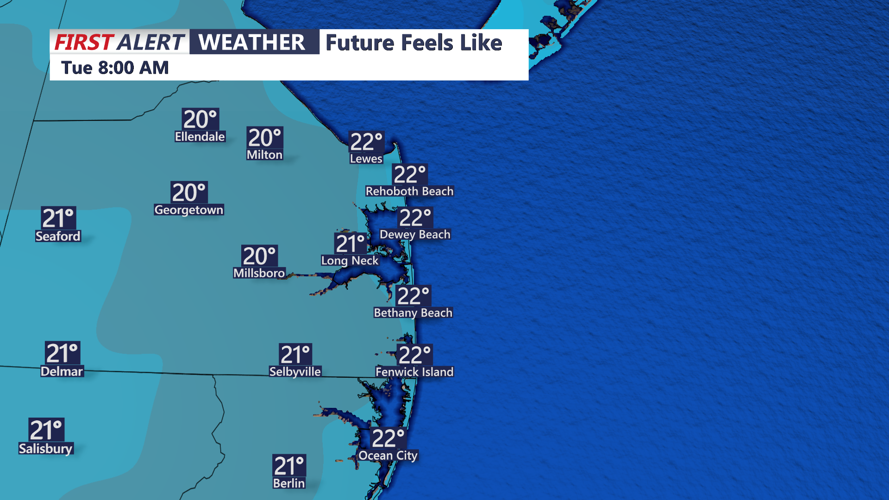
A deep upper-level trough will pull modified arctic air over the region, keeping temperatures in check. Highs on Monday are forecast to reach only the mid-40s to low-50s across the peninsula, roughly 10–15 degrees cooler than Sunday. With northwest winds 15–25 mph and higher gusts around 30–35 mph, it will feel colder: wind chills in the 30s at midday, falling into the 20s by late afternoon.
Clouds will be stubborn, with a thick stratocumulus deck expected for much of the day under cold northwest flow. A few breaks of sun are possible, but the overall feel will be raw and blustery, especially in open areas and along the coast. Drivers should be prepared for crosswinds on north–south routes, and residents are encouraged to secure loose outdoor decorations, trash cans and lightweight furniture.
Monday evening: first true taste of winter chill
Through Monday evening, skies remain mostly cloudy to partly cloudy and winds stay elevated from the northwest, though gusts gradually ease. Temperatures will drop through the 40s into the 30s after sunset, with wind chills dipping into the teens and 20s inland by late evening and overnight as strong high pressure builds to the southwest.
While no widespread wintry precipitation is expected over the lower Delmarva, the cold air will mark the coldest stretch of the season so far. We urge residents to dress in layers for the Monday evening commute, protect sensitive plants, and ensure outdoor pets have adequate shelter from the wind and cold.