



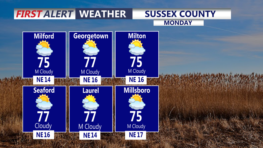

DELMARVA - A stalled frontal boundary south of the region will keep unsettled weather in place across Sussex County from early Monday morning through early Tuesday morning.
Monday will begin with areas of rain, low clouds and possible patchy fog. Periods of rain are expected to continue at times through the day, although the risk of flash flooding remains low.
Temperatures will stay well below normal, with highs likely struggling to get out of the 60s. Northeast winds will increase during the day, especially near the coast.
Conditions along the Delaware beaches will become increasingly rough Monday. Northeast winds are expected to reach 15 to 20 mph, with breaking waves of 2 to 4 feet and a moderate risk of dangerous rip currents.
Marine conditions will also deteriorate, with stronger northeast winds and building seas continuing into Monday night.
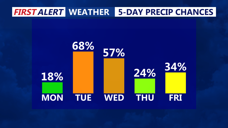
Cloudy and damp conditions are expected to persist Monday night into early Tuesday morning, with additional periods of rain possible. Rain chances may increase further Tuesday as the stalled boundary attempts to lift northward again.
