


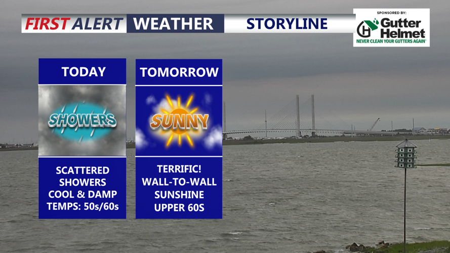


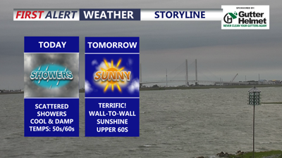
DELMARVA -- A cool and raw day is underway across Delmarva, with temperatures running about 25 to 30 degrees cooler than yesterday. Highs will stay mainly in the 50s and 60s as scattered showers continue through the day before tapering off late this afternoon into the early evening. Rainfall totals on the order of 0.10" to 0.30". Northeast winds will gust between 25 and 30 mph, adding to the chilly feel.

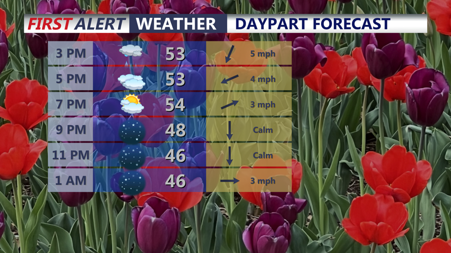
Showers through late this afternoon, skies clear into the night and turns chilly with lows in the low to mid 40s.
Tonight will turn mostly clear and chilly, with lows dropping into the low to mid 40s across Delmarva.

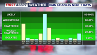
Scattered showers today, another chance for rain arrives Wednesday night as a cold front pushes through.
Sunshine returns in full force Tuesday as high pressure begins to shift offshore. Expect wall-to-wall sunshine with afternoon highs recovering into the upper 60s.
Wednesday brings another step warmer, with highs pushing into the low to mid 70s. Winds will become gusty out of the southwest, with gusts up to 40 mph possible under partly sunny skies. Showers are expected to increase from west to east Wednesday afternoon, with the greatest coverage likely Wednesday night as a trough and cold front move through the region. A few thunderstorms will also be possible, and any stronger storms could produce locally gusty winds depending on how much instability develops.
The upper-level pattern will remain active through the middle and latter part of the week. A strong upper-level trough will shift east of the region Tuesday, while another trough arrives Wednesday into Thursday. Some forecast guidance suggests this system could close off over the Mid-Atlantic and Northeast later Wednesday into Thursday, while other guidance keeps it as an open but sharpening trough. Either way, showers are likely Wednesday afternoon and Wednesday night.
Most of the shower activity should shift east and northeast by Thursday, though additional showers could develop Thursday and possibly into Friday if the colder air aloft lingers overhead.

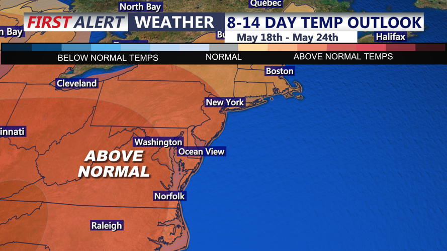
Well above average temperatures expected this weekend into next week.
