


DELMARVA - Tuesday marks a shift to quieter and cooler conditions along the Delaware and Maryland coast after Monday night’s round of heavy thunderstorms and strong winds.
Behind the departing cold front, much drier and colder air is settling over Sussex County and the Ocean City area. Skies will be mostly sunny Tuesday, but temperatures will run about 15 degrees cooler than Monday’s highs. Most coastal towns will top out in the mid to upper 50s Tuesday afternoon.
Gusty northwest winds between 10 to 15 mph—with gusts up to 25 mph—will add to the chill, especially near the shoreline. Despite the sun, the air will feel brisk through the day.
Overnight Tuesday into early Wednesday, temperatures will drop into the mid to upper 30s. While it's cold enough for frost, the dry air and persistent breeze will likely prevent any significant frost formation.
By Wednesday, high pressure starts to shift offshore, and winds will turn more easterly, bringing a bit more moisture off the ocean. Clouds will gradually increase through the day, and temperatures will remain slightly below average, hovering in the low to mid 50s.
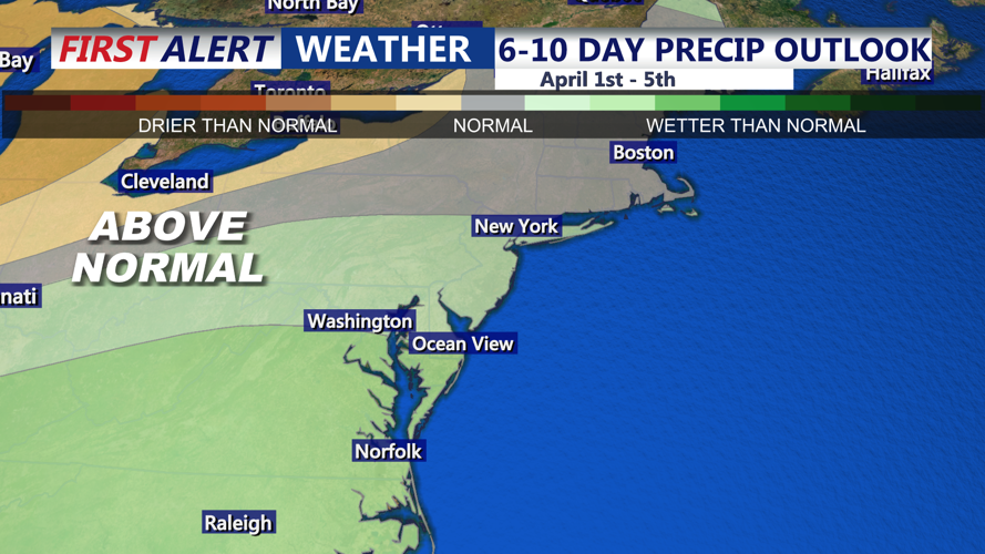
Wednesday evening will bring a slow shift toward milder conditions as a warm front begins lifting northward. While most of the area will remain dry, a few scattered showers may develop overnight into Thursday, marking the start of a more unsettled, spring-like pattern heading toward the weekend.