


DELMARVA -- After a damp start to the day with morning showers across Delmarva, conditions will turn drier through the afternoon. An upper-level low pressure system moving in from the Great Lakes will continue to develop south and east across the region today, helping to keep clouds and a breeze around even as rain chances fade.
Rainfall totals from late last night into this morning generally ranged from 0.10” to 0.35”, which was not enough to significantly help the severe drought conditions impacting Delmarva.

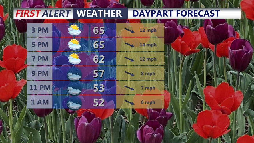
Partly cloudy skies and highs in the mid to upper 60s, winds will be out of the northwest gusting 25-30 mph.
This afternoon will be partly cloudy and breezy, with highs in the mid to upper 60s. Northwest winds will be gusty at times, reaching 25 to 30 mph. Tonight will remain partly cloudy, with overnight lows falling into the upper 40s to low 50s.
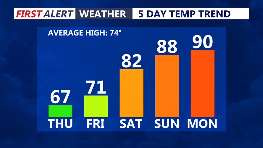
Friday will bring more pleasant weather to Delmarva. Highs will reach the low 70s with a lighter breeze, though northwest flow will continue. From there, temperatures will begin to climb as a warmer pattern builds into the region for the weekend and early next week.

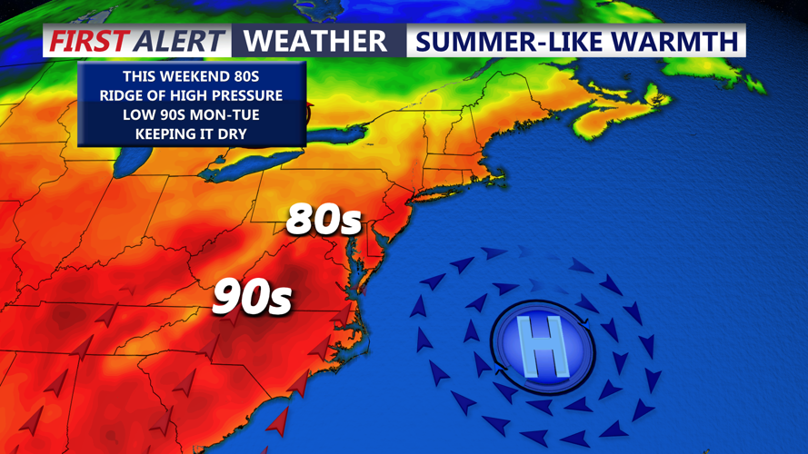
Looking great in Dover this weekend, warming up under sunny skies.
An upper-level ridge will strengthen over the Eastern United States this weekend and into next week, bringing above-normal and summerlike temperatures to Delmarva. At the surface, high pressure over the western Atlantic will anchor offshore, allowing a warm southerly flow to develop for several days.

Temperatures soaring into the 80s and 90, late this weekend and early next week.
