


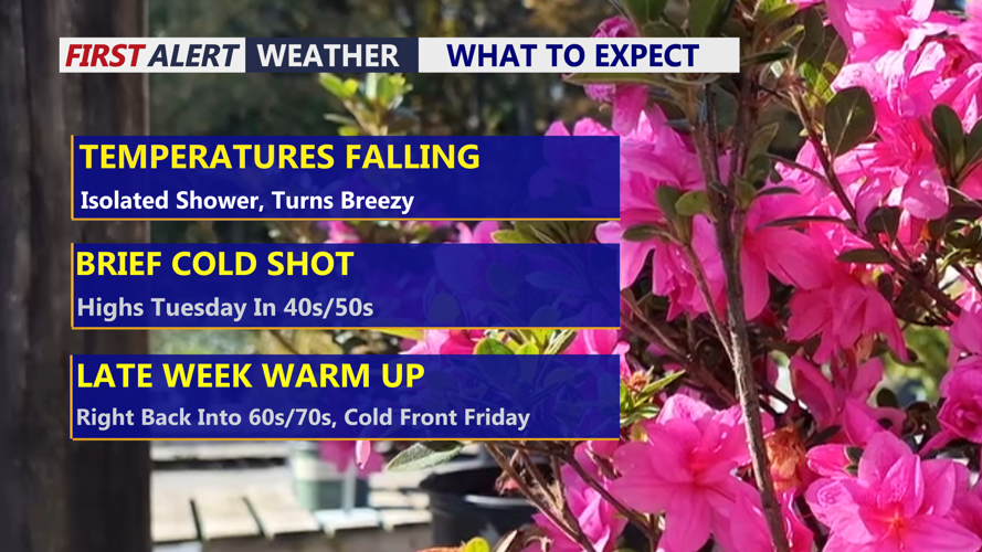
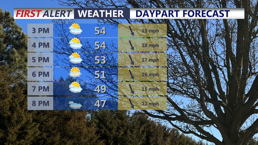

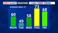


DELMARVA -- Today marks a much cooler and breezy turnaround across Delmarva in the wake of a strong cold front that pushed through this morning. In another reverse day for the region, the highest temperatures were reached just after midnight ahead of the front, with readings steadily falling through the day. Afternoon temperatures will slip into the low 50s as skies gradually clear, while strong north winds gusting between 30 and 35 mph make it feel even cooler.

Temperatures falling into the low 50s, winds gusting out of the north to 35 mph.
Tonight, winds will slowly ease as skies remain mainly clear. Temperatures will drop into the upper 20s to low 30s by early Tuesday morning, setting up a chilly start to the day.

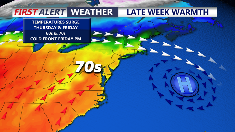
Quick cool down through Tuesday, before we warm right back up into the 60s and 70s.
Tuesday will feature mainly sunny skies but continued cool conditions, with afternoon highs only reaching the upper 40s to low 50s. A warming trend begins Wednesday as southwest winds return, helping temperatures rebound into the upper 50s. By Thursday, much milder air surges back into Delmarva, sending highs into the low 70s under mostly cloudy skies.

The 70s return back to Delmarva Thursday ahead of a cold front Friday.
The next cold front approaches Friday afternoon into Friday evening, bringing the chance for scattered showers and even a rumble of thunder. Cooler air follows for Saturday, with highs dropping back into the 40s and 50s. Despite the chill, the weekend looks dry and sunny, and temperatures should begin recovering quickly by Sunday, when highs return to the upper 50s.