


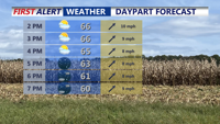


DELMARVA -- A cold front sweeping across Delmarva this evening will end today’s mild stretch and open the door to a much colder pattern heading into the Thanksgiving holiday. Highs this afternoon reached the upper 60s to near seventy under partly cloudy skies, giving the region one last comfortable day before a notable cooldown arrives.

Highs 65-71 this afternoon, pleasant dry evening for any plans, cold front pushes through late tonight.
Tonight, winds will increase sharply behind the front. Gusts are expected to reach 25 to 35 mph. Temperatures will fall into the low to mid-thirties by daybreak, setting the stage for a colder end to the week.
Strong high pressure building in from the west will keep conditions dry Thursday and Friday, but the pressure gradient between the departing low over Canada and the incoming high will maintain brisk winds both days.

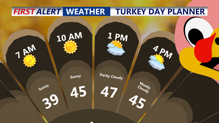
Partly cloudy skies for Thanksgiving, blustery with gusts to 25-30 mph.
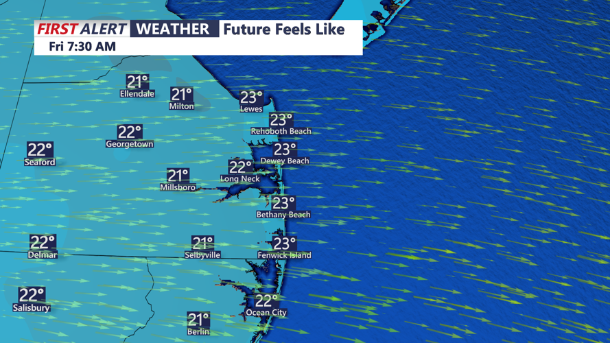
Gusts Thanksgiving may reach around 30 mph, increasing to 30 to 40 mph on Friday. High temperatures will hold in the 40s, under partly cloudy skies, while lows will dip into the mid-20s to around thirty degrees each night. Wind chills will fall into the twenties at times, especially during the morning hours Friday.

Wind chills by Friday morning will be in the 20s, wind gusts to 40 mph possible through the afternoon.
Below-normal temperatures will persist Saturday as high pressure remains in control. Early morning lows in the low to mid twenties will precede afternoon highs in the low to mid-forties, about eight to ten degrees below what’s typical for late November.
A warming trend arrives Sunday and Monday as another low-pressure system and its fronts approach the coast. Highs will rebound into the upper forties and low fifties, though the milder readings come with increasing chances for rain. Light showers are possible Sunday, with better chances Sunday night into Monday.
Looking ahead to early next week, forecast guidance suggests a secondary storm system may approach the East Coast toward midweek. With cooler air already in place behind Monday’s front, temperatures are expected to slip slightly below normal again on Tuesday as the next system organizes offshore.