



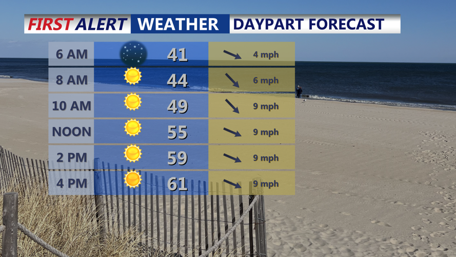

DELMARVA - Residents in Sussex County will wake to mostly clear skies Thursday morning, thanks to a ridge of high pressure gradually shifting eastward across the Mid-Atlantic. Morning temperatures will hover around freezing in inland areas, recovering steadily as the sun rises. Sunshine will dominate throughout the day, with temperatures climbing into the low to mid 60s by afternoon. Though the sun will feel warm, breezy west-northwest winds gusting between 20 to 25 mph may make it feel slightly cooler.
Thursday night into Friday: Calm and dry
Conditions will remain dry and quiet Thursday night as the high pressure system moves offshore and begins extending into southeast Canada. Temperatures will drop into the upper 30s to low 40s under mostly clear skies. Winds will gradually shift more southerly as the atmosphere sets up for a return flow pattern heading into Friday.
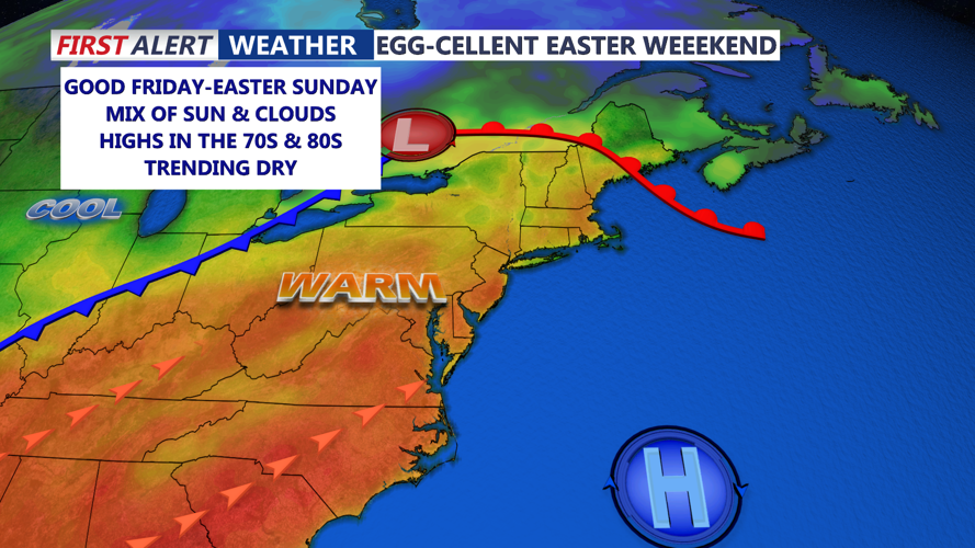
Friday is expected to remain mostly dry across Sussex County with increasing cloud cover in the afternoon. Highs will again reach the 60s, but a warm front lifting to the north may bring isolated showers to more northern parts of the region. Sussex County is likely to stay dry during the daytime hours.
Friday night into Saturday morning: Rain chances rise
Rain chances increase across Sussex County Friday night into early Saturday morning as a cold front pushes into the area. While widespread heavy rain is not expected initially, scattered showers may begin developing overnight into the pre-dawn hours of Saturday. Low temperatures will remain in the mid to upper 40s due to the increased cloud cover and south winds.
Though no severe weather is forecast, residents planning early Saturday activities should monitor forecasts for updates, as the pattern signals a shift to a wetter weekend.
