


DELMARVA --A changing weather pattern will bring a taste of early spring chill and bright skies to the Delmarva Peninsula starting Saturday night, as a cold front sweeps through the region, followed by a stretch of dry and increasingly warm days.

Cold front brings clouds tonight, but still a rather mild night.
A cold front will push through Delmarva Saturday evening, shifting winds from the west to northwest and becoming briefly gusty overnight. Winds may reach up to 20–25 mph before easing to around 10 mph by dawn. Skies will gradually clear, and low temperatures will dip into the low to mid-60s.
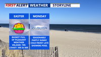
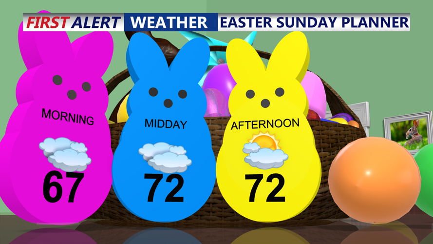
Easter Sunday will be seasonably cool and breezy under the influence of high pressure building in from the northwest. Expect mostly sunny skies with a few afternoon clouds. Inland areas will reach the low to mid-70s, while coastal areas stay cooler with highs in the upper 50s to mid-60s. North winds may gust up to 30 mph.

Look for a cloudy start with sunshine through the afternoon.
Sunday night will remain quiet, although light easterly flow may introduce some patchy low clouds or drizzle. Temperatures will fall into the 50s across much of Delmarva.
With high pressure shifting east, winds turn southeasterly Monday. Cooler air will linger along the coast, with highs in the 50s there, while much of the Eastern Shore of Maryland sees temperatures in the low 70s. Some low clouds may persist through the day.

Rain chances ramp up Tuesday and then late next week.
Another cold front approaches late Monday but will weaken as it nears southern Delaware. Rain chances diminish across central and southern Delmarva. Overnight lows fall to the upper 50s to around 60.
By Tuesday, the front sweeps through, clearing out the marine layer and allowing temperatures to rebound. Expect highs in the low 70s to near 80, depending on sun coverage.
High pressure settles in Tuesday night through Thursday, promoting dry and calm weather. Skies will feature partial sunshine and gradually warming temperatures. Wednesday highs in the low 70s with overnight lows in the upper 40s to low 50s. Thursday, even warmer, with inland highs reaching the mid to upper 70s, and 60s near the coast. Skies remain partly sunny.
By next weekend, a stalled front may keep the region unsettled with occasional showers and continued mild temperatures.