


DELMARVA - Sussex County, Delaware, will turn colder and calmer late Tuesday evening as strong Canadian high pressure builds closer to the region, setting the stage for freezing temperatures overnight and another chilly night by late Wednesday.
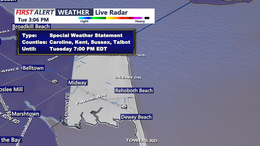
The county remains under a Special Weather Statement into early Tuesday evening for an elevated risk of fire spread, driven by very dry air, low humidity and earlier wind gusts of up to 35 mph. Those conditions are expected to improve as the evening goes on, with winds diminishing and humidity recovering.
A much drier air mass has settled over the area, with dew points falling into the teens and low 20s. That dry air, combined with breezy northwest winds and lingering cold air advection, created an elevated fire-weather concern Tuesday afternoon and early evening. By late Tuesday evening, however, the center of high pressure will move closer, allowing winds to ease and the fire-spread threat to decline.
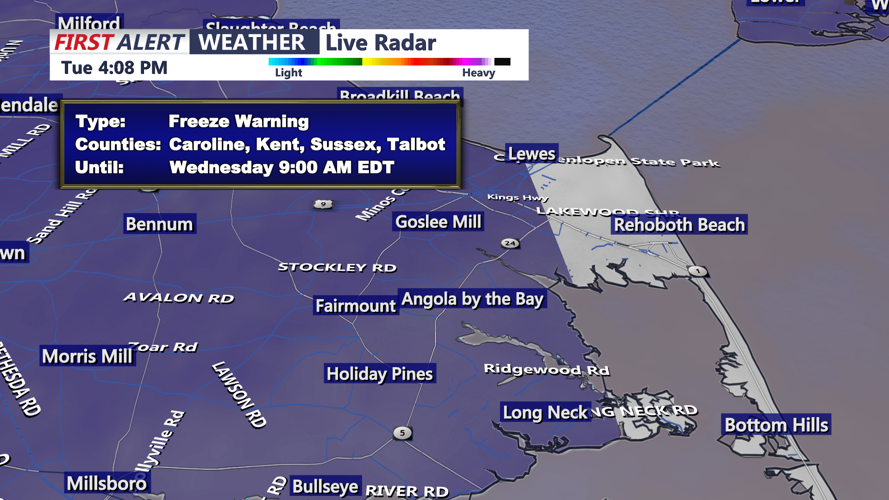
Attention then turns to the cold. A Freeze Warning remains in effect for late Tuesday night through early Wednesday morning in Sussex County, where the growing season is active. Overnight lows are expected to fall into the upper 20s to lower 30s by Wednesday morning. While the air mass will be cold enough for a freeze, widespread frost formation may be somewhat limited because the air remains very dry and a light breeze may continue through part of the night.
Wednesday will stay cool but quieter. Winds will be much lighter than Tuesday, and while dry air will remain in place away from the coast, the reduced wind will significantly lower the risk of fire spread. Skies should remain mostly clear to partly sunny, with a chilly onshore breeze developing later in the day.
By late Wednesday evening, another round of cold-weather concerns will begin to build. A Freeze Watch is in effect for Wednesday night into early Thursday morning for Sussex County, signaling the potential for another period of subfreezing temperatures. As winds turn more easterly to southeasterly and moisture slowly recovers, conditions may become more favorable for frost development Wednesday night, especially inland. Along the immediate coast, temperatures are expected to stay a bit milder, though patchy frost could still develop if winds become calm early enough.
Residents should use caution with outdoor burning Tuesday evening, protect sensitive plants and vegetation both overnight and again Wednesday night, and be prepared for a cold start Wednesday morning across Sussex County.