


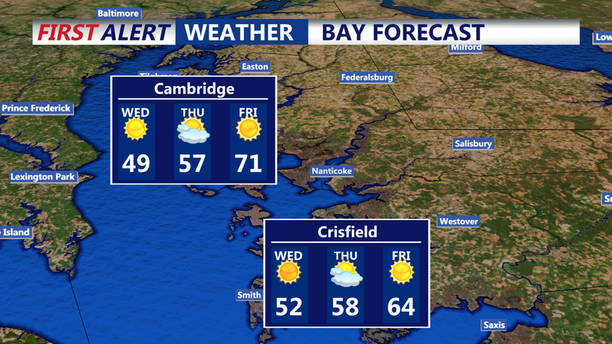


DELMARVA - A cold and very dry air mass will keep Delmarva, under a sharp chill from early Wednesday morning through early Thursday morning, with a Freeze Warning in effect early Wednesday and a Freeze Watch posted for Wednesday night into early Thursday.
Temperatures early Wednesday are expected to fall into the upper 20s to lower 30s as strong Canadian high pressure settles over the region. The warning remains in place for the early morning hours, when subfreezing temperatures could damage sensitive vegetation and harm unprotected outdoor plants where the growing season is underway.
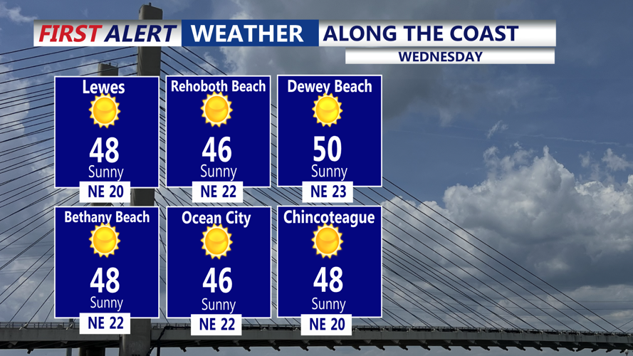
Despite the cold, frost formation early Wednesday may be somewhat limited because the air mass remains very dry and at least a light breeze may continue overnight. Even so, the cold itself will be enough to create freezing conditions across much of Sussex County.
Conditions during the day Wednesday will be quieter but still cool. Winds will be much lighter than they were Tuesday, and while the dry air will remain in place, the lower wind speeds will significantly reduce the threat of rapid fire spread. Skies should remain mostly clear to partly sunny, with a chilly feel continuing through the afternoon.
By Wednesday night, attention shifts to another round of cold weather. A Freeze Watch is in effect for Sussex County from Wednesday night into early Thursday morning as temperatures are forecast to dip back into the mid- to upper 20s and lower 30s. With surface high pressure shifting offshore, winds are expected to turn easterly to southeasterly, allowing some moisture to return. That could support more frost development overnight, especially inland, if winds become light enough.
Some cloud cover may begin to develop closer to daybreak Thursday as low-level moisture increases, which could affect just how widespread frost becomes. Still, the risk of damaging cold remains high enough for the watch to stay in place.
Residents should protect tender plants, cover sensitive vegetation and be prepared for two cold starts in a row, with the most widespread freeze conditions expected early Wednesday and another possible freeze or frost episode by early Thursday.
