





DELMARVA - A stubborn front that has lingered across the region will continue sliding south through Friday, gradually opening the door to more comfortable weather across Sussex County.
Thursday evening and overnight should remain mainly dry, with partly cloudy skies and lingering humidity. Lows are expected to fall into the lower 70s inland and the mid-70s along the Delaware beaches.
The front will continue moving south as a cold front Friday, allowing slightly cooler and less humid air to begin filtering into southern Delaware. The bigger drop in humidity, however, is expected to hold off until Saturday.
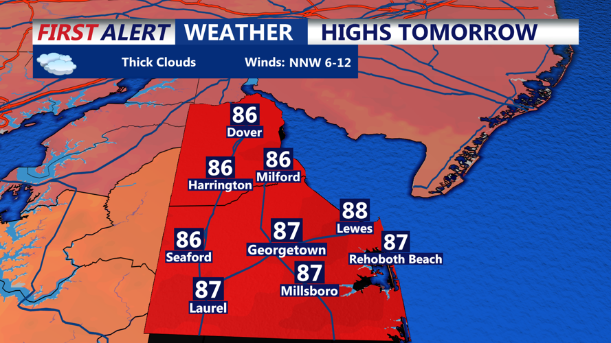
Friday will feature plenty of dry time, with highs reaching the upper 80s across inland Sussex County and generally the low to mid-80s near the beaches. Winds will turn northeast to east at about 5 to 10 mph.
A few showers could develop late Friday afternoon and into Friday night as the front settles farther south. The National Weather Service has a roughly 30% chance of showers near the Delaware beaches Friday afternoon, with isolated thunderstorms also possible. Rainfall should generally be light outside of any heavier shower or thunderstorm.
Along the coast, the risk of dangerous rip currents is expected to remain low Friday, with breaking waves around 2 feet or less and onshore winds generally 10 mph or weaker. No widespread marine hazards are expected through Friday.
There is also a chance for spotty minor tidal flooding around Thursday evening’s high tide along the Atlantic coast and Delaware Bay. Astronomical tides remain elevated following Wednesday’s new moon, although water levels are expected to begin trending lower.
By Saturday, high pressure should settle overhead, bringing what forecasters expect to be the driest and least humid day of the weekend.
