


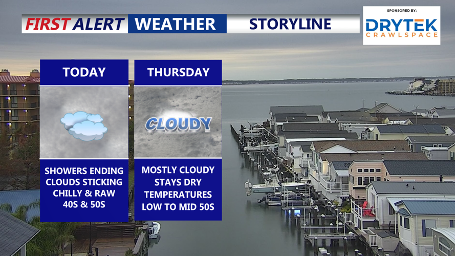


DELMARVA -- Clouds continue to dominate skies across Delmarva today as a fair amount of lingering moisture combines with a light north to northeast wind. A mostly cloudy raw day afternoon on the peninsula. Highs will hold in the upper forties to low fifties.

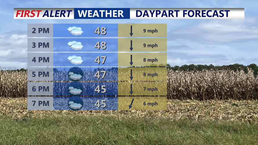
Gloomy raw afternoon, falling into the mid 40s through the evening.
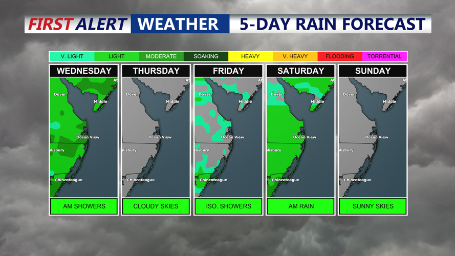
Tonight, high pressure centered over the lower Great Lakes drifts eastward toward New England, keeping conditions mainly dry across Delmarva. A weak frontal boundary lingers nearby, allowing for spotty drizzle in a few locations. Overnight lows will fall into the upper thirties to low forties.

Next chance for rain comes late Friday night-Saturday as an area of low pressure passes to our south.
A more zonal flow aloft and a light northeasterly surface wind will help keep clouds in place, especially across the southern half of Delmarva. While a sprinkle cannot be ruled out, the region should remain largely precipitation-free. Highs will reach the low to mid-fifties, with Thursday night lows in the mid- to upper thirties and low forties.
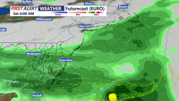
A weak cold front tied to low pressure over eastern Canada slides through Delmarva on Friday and then stalls from the Peninsula westward. Energy riding along this boundary supports a developing low near the Tennessee Valley, which tracks east and offshore Saturday.

Weekend could start a bit damp and rainy, drying out through the afternoon.
Model guidance varies on the extent and placement of precipitation, but rain chances increase Friday night into Saturday, especially if the low tracks closer to Delmarva. Temperatures stay seasonable.
High pressure builds in, bringing a dry day with more sunshine returning across the region. This will be the brightest stretch of the extended forecast.
Another cold front arrives later Monday as a stronger upper-level trough dips into the Northeast. If the more robust model solutions verify, rain chances will increase with the front’s passage, followed by gusty northwest winds on Tuesday as high pressure gradually returns.