


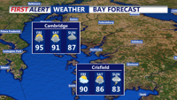
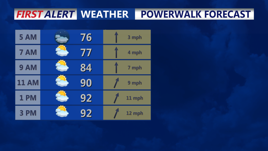


DELMARVA - The weather forecast for Delmarva suggests that any diurnal convection that materializes on Thursday will diminish quickly into the evening. Although some overnight convection is possible, it is unlikely due to the current synoptic setup and waning diurnal instability. Scattered clouds will increase overnight with remnants of convective debris arriving from upstream. Expect a warm and muggy night with lows in the low to mid-70s.
A rather strong upper-level trough will dig across the Great Lakes and Ohio Valley on Friday, approaching the Delmarva area by Friday night. This trough will slowly progress across the Mid-Atlantic over the weekend, bringing very wet weather to the region.
A surface low across the Ohio Valley will help bring a surge of moisture into the region on Friday, keeping surface dew points elevated in the low to mid-70s. Despite increased cloud coverage possibly lowering afternoon temperatures by a few degrees compared to Thursday, the higher dew points will keep heat indices in the 100-105 range.
The upper-level trough will also bring favorable dynamic forcing for increased chances of showers and thunderstorms from Friday afternoon into the nighttime hours. Although instability levels will support stronger thunderstorms, deep-layer shear is forecast to be weak. However, precipitable water (PWAT) values will surge into the 2"+ range, leading to increased chances of heavy downpours with any thunderstorms.
If stronger cores develop and are sustained, isolated severe thunderstorms with locally strong and damaging downburst wind gusts could occur Friday afternoon and evening. Some convection may linger into the overnight period before moving offshore or dissipating. Another warm and muggy night is expected, with lows in the low to mid-70s across much of the region.
The Delmarva region should prepare for continued heat and humidity, along with potential heavy rainfall and thunderstorms over the weekend as the upper-level trough moves through.
