





The heaviest rainfall has moved out of Sussex County, and additional flooding is not expected as a slow-moving cold front continues pushing toward the Atlantic coast Friday afternoon and evening.
A few additional rounds of showers will move across southern Delaware through the afternoon, but rainfall will be considerably lighter than the downpours experienced earlier Friday morning. Additional rainfall amounts should generally be limited to a few tenths of an inch.
Communities across western Sussex County, including Seaford, Laurel and Bridgeville, should experience improving conditions first as drier air gradually moves into the region.
Farther east, locations including Georgetown, Millsboro, Lewes, Rehoboth Beach, Bethany Beach and Fenwick Island may continue experiencing scattered showers into the late afternoon and early evening.
An isolated thunderstorm cannot be ruled out near the coast, although the overall threat remains low as the deepest moisture and atmospheric instability move offshore.
Rainfall will gradually diminish from west to east, with most showers expected to end across Sussex County by late Friday evening.
A stronger secondary cold front will cross Delmarva overnight, bringing another push of cooler and drier air into the region. Skies will gradually clear, and northwest winds will begin increasing toward Saturday morning.
Overnight temperatures will fall into the 40s across much of Sussex County, marking a noticeable change from the unusually mild conditions experienced earlier in the week.
Saturday will bring a much different weather pattern as the departing low-pressure system strengthens east of New England.
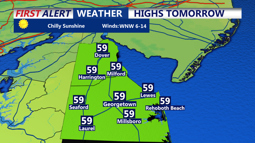
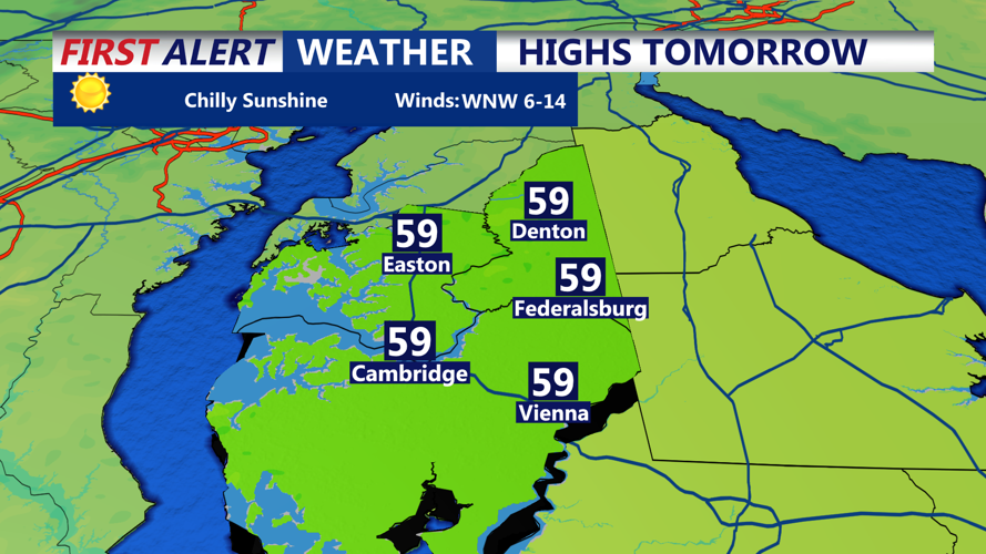
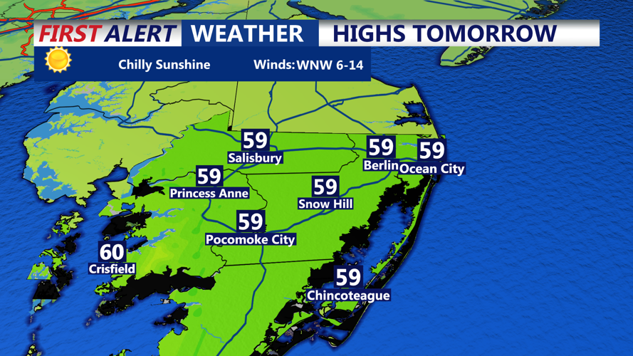
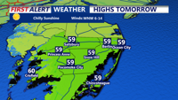
A combination of sunshine and clouds is expected throughout the day, with afternoon temperatures reaching the upper 50s to around 60 degrees. However, a brisk west to west-northwest wind will make it feel several degrees cooler.
Sustained winds of 10 to 15 mph will be common, with occasional gusts reaching 25 mph, especially across open areas and coastal communities from Prime Hook and Lewes south through Rehoboth Beach, Bethany Beach and Fenwick Island.
Despite the cooler and breezier conditions, Saturday should remain dry across Sussex County, making it a favorable day for outdoor activities with an extra layer of clothing.
The stronger winds will be associated with a developing pressure difference between departing low pressure over the Northeast and high pressure building across the central United States.
By Saturday evening, winds will gradually diminish as the low-pressure system pulls farther away from the region.
Saturday night will turn chilly, with overnight temperatures dropping into the upper 30s to middle 40s. Inland communities such as Georgetown, Seaford and Laurel could experience some of the colder readings, while temperatures near the Atlantic beaches should remain slightly milder.
Sunday will feature more comfortable conditions as sunshine returns and winds become lighter. Afternoon highs are expected to climb into the lower 60s across much of Sussex County.
Skies will remain mostly clear to partly cloudy, providing a pleasant conclusion to the weekend.
Looking ahead, generally dry and fair weather is expected to dominate the forecast from early through the middle of next week, with no significant weather systems currently anticipated.
For residents and visitors along the Delaware beaches, the main weather story will be the transition from Friday's wet conditions to a cooler, breezy Saturday followed by a milder and calmer Sunday.
The risk of additional flooding has diminished significantly, and the remaining showers should end by late Friday evening, setting the stage for an improving weekend across southern Delaware.
