




DELMARVA - Showers and thunderstorms are expected to become increasingly widespread across Sussex County on Thursday as a strong cold front approaches the Delmarva Peninsula, bringing the potential for severe weather and torrential rainfall through Thursday night.
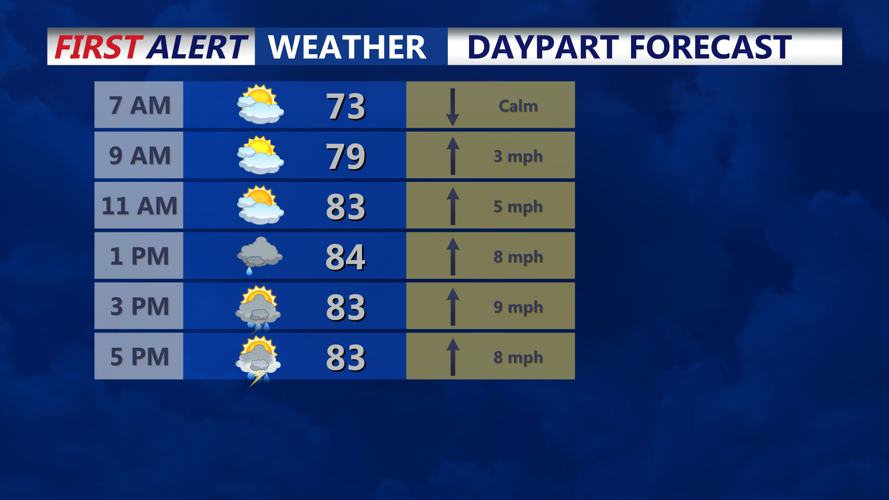
Conditions will turn increasingly humid early Thursday as a warm front settles across portions of the Delmarva region. Multiple rounds of showers and thunderstorms are expected to develop during the day, with the greatest concern for stronger storms during the afternoon and evening.
There is a Slight Risk for severe weather, with forecasters warning that some thunderstorms could produce damaging wind gusts. Wind shear of 30 to 40 knots could allow storms to organize into clusters capable of producing locally severe conditions.
An isolated tornado also will be possible, particularly near the warm frontal boundary across the Delmarva Peninsula and southern New Jersey. Isolated large hail cannot be ruled out, although extensive cloud cover could limit how unstable the atmosphere becomes.
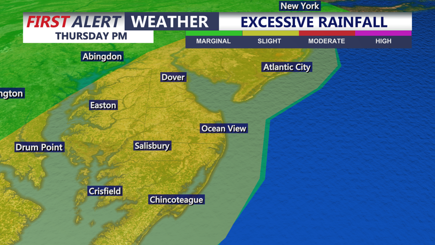
Heavy rain may be an equal or greater concern. A moisture-rich air mass is expected to move into the region Thursday, allowing thunderstorms to produce rainfall rates of 2 to 3 inches or more per hour in some locations.
General rainfall totals of 1 to 2 inches are expected across the broader region, with localized amounts of 3 to 5 inches possible where the heaviest storms occur. Rapid rainfall could lead to areas of poor drainage or localized flash flooding.
The most significant severe weather and heavy-rain threat should begin to diminish Thursday night as the cold front moves through. Showers and thunderstorms may linger into early Friday morning before conditions gradually improve.
Additional chances for showers and thunderstorms are expected through the weekend as a frontal boundary remains near the region.
