


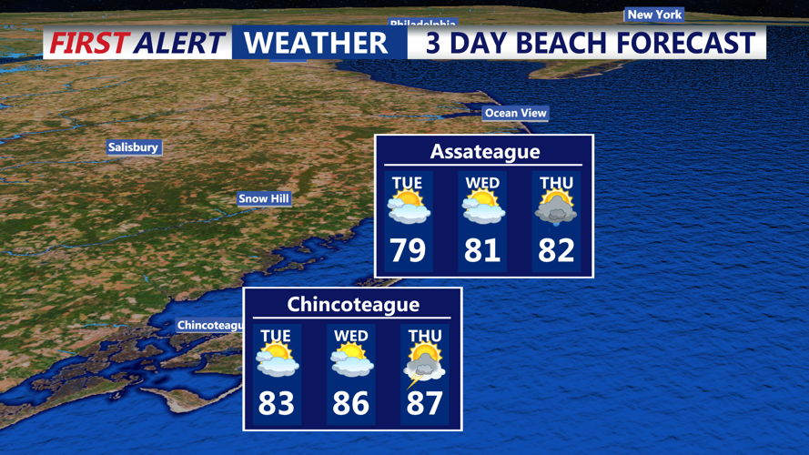
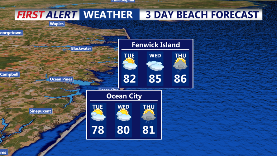

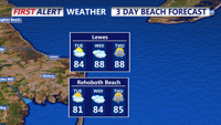

DELMARVA — Coastal communities from Lewes to Fenwick Island, along with nearby Ocean City, Md., will experience a hot and humid stretch from early Tuesday into early Thursday, as a warm, moisture-rich air mass settles over the region.
Tuesday morning will start mild and muggy, with lows in the low 70s and some patchy fog possible near the shore. Skies will quickly clear to a mix of sun and clouds, and temperatures will climb into the mid- to upper 80s along the coast by afternoon. Southerly breezes will pull in higher dew points — near 70 — pushing heat index values into the low 90s.
By Tuesday evening, cloud cover will increase ahead of a surface trough. Scattered showers or thunderstorms could develop late, most likely inland but with potential to drift toward the beaches. Any storm that forms may produce heavy rainfall due to abundant moisture.
Wednesday will be the hottest day of the period, with highs reaching the upper 80s along the coast and low 90s just inland. Humidity will remain high, keeping heat indices in the mid- to upper 90s. The approach of a cold front from the northwest will trigger a higher chance of showers and thunderstorms during the afternoon and evening. While widespread severe weather is not anticipated, localized downpours could be heavy.
By early Thursday morning, the cold front will push offshore, ushering in lower humidity and more comfortable conditions to wrap up the week.
