



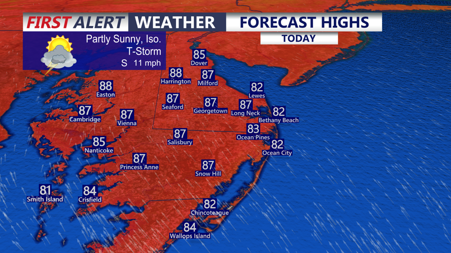

DELMARVA -- The humidity is back across Delmarva today following the passage of a warm front, with partly sunny skies and temperatures climbing into the mid-80s.

Highs in the mid 80s, partly sunny and isolated shower and storm possible late this afternoon-evening.
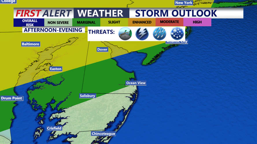
A few isolated showers are possible during the day, with thunderstorms expected to develop late this afternoon and evening, initially favoring areas west of the peninsula. Some of those storms are expected to push onto Delmarva.

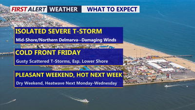
The chance of severe storms increases the further west and north you go, not expecting any severe storms for the coast.
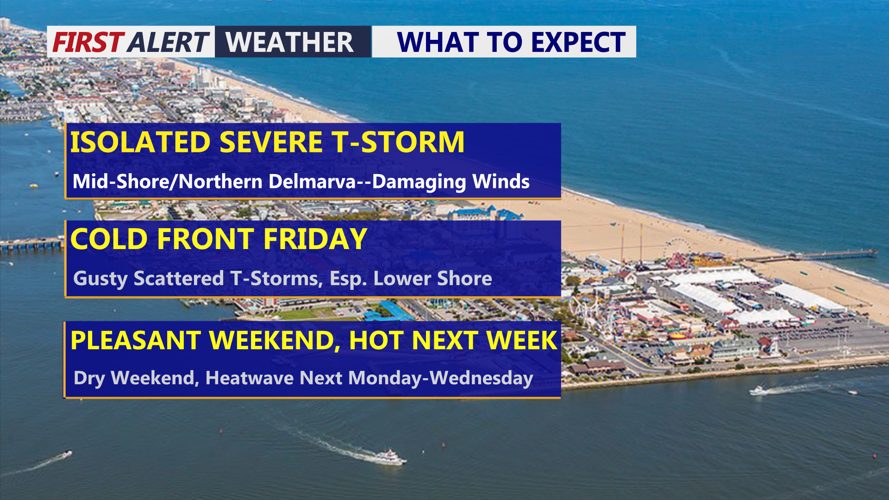
The greatest risk for severe thunderstorms will stretch from the Mid-Shore northward through Kent and Sussex counties. Damaging wind gusts, hail and torrential downpours will be the main threats. An isolated tornado cannot be ruled out, particularly from the Dover area northward.
Storm coverage should decrease tonight, although an isolated thunderstorm will remain possible under partly to mostly cloudy skies. Overnight lows will fall into the upper 60s to lower 70s.
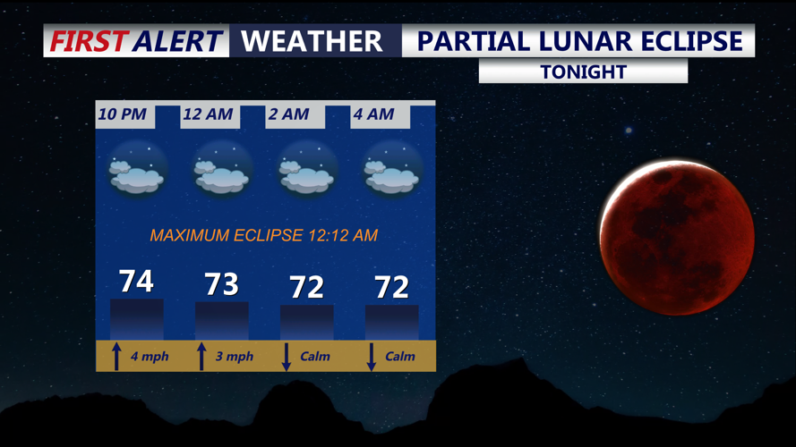
Clouds could interfere with viewing at times, but sky watchers will have a chance to see a deep partial lunar eclipse tonight into early Friday. The eclipse reaches maximum coverage at 12:12 a.m. The moon may take on a reddish or bronze appearance as Earth moves between the sun and moon, casting its shadow across the lunar surface. No special eclipse glasses are needed for a lunar eclipse, although binoculars or a telescope can provide a closer view.

You don't need any special glasses to view this eclipse that will have a reddish color.
A cold front will move through Delmarva Friday, keeping skies mostly cloudy with highs in the mid-80s. Scattered showers and thunderstorms are expected to develop during the afternoon and evening. A few storms could become severe, especially across the Lower Shore, with damaging winds and torrential rainfall the primary concerns. Localized flash flooding will also be possible where the heaviest rain persists.
Conditions improve quickly for the weekend. A few clouds may linger Saturday morning before giving way to a pleasant afternoon with highs in the lower 80s. Sunday looks mostly sunny and warmer, with temperatures reaching the upper 80s.
Summer heat then makes another run at Delmarva as the calendar turns to September on Tuesday. High temperatures are expected to reach the lower to middle 90s Monday through Wednesday, potentially producing an early-week heat wave.
Another cold front is expected to arrive Thursday, bringing a chance for scattered thunderstorms and putting an end to the stretch of September heat.
