


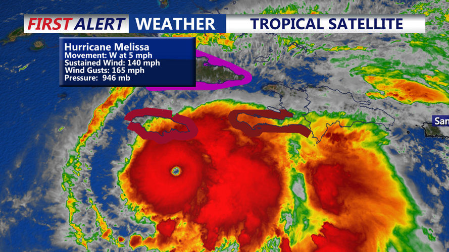
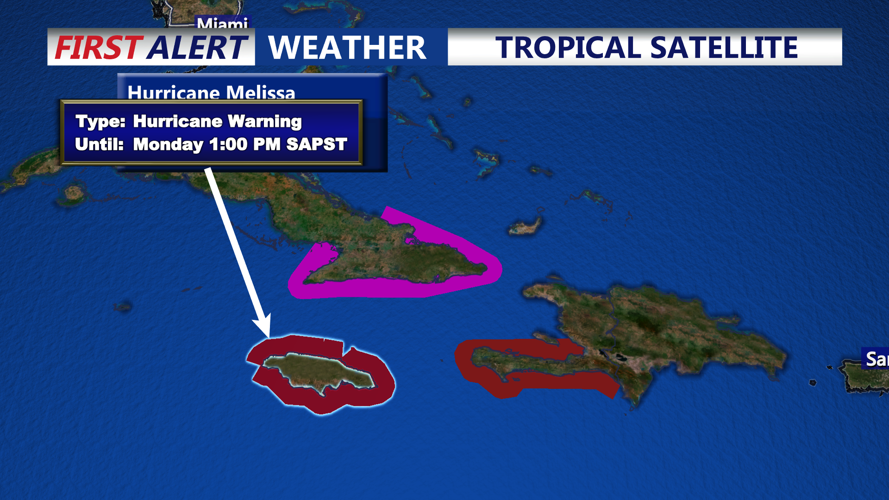


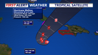

DELMARVA - At the latest bulletin, Melissa’s center sits roughly 120 miles south-southeast of Kingston, Jamaica, with sustained winds near 140 mph and moving westward at about 5 mph. Forecast models call for the storm to reach Jamaica late Monday into Tuesday, potentially making landfall as a major hurricane (Category 4 or above) and bringing extremely heavy rainfall — up to 30–40 inches in some areas — along with catastrophic flash flooding, landslides and storm surge.
Historically, Jamaica’s last major direct hit by a Category 3 storm posed severe infrastructure and flooding problems; with Melissa likely surpassing that intensity, the humanitarian and physical threat is amplified.
From the vantage of Sussex County, Delaware, the immediate risk remains low — no U.S. watches or warnings have been issued for the continental United States at this time.
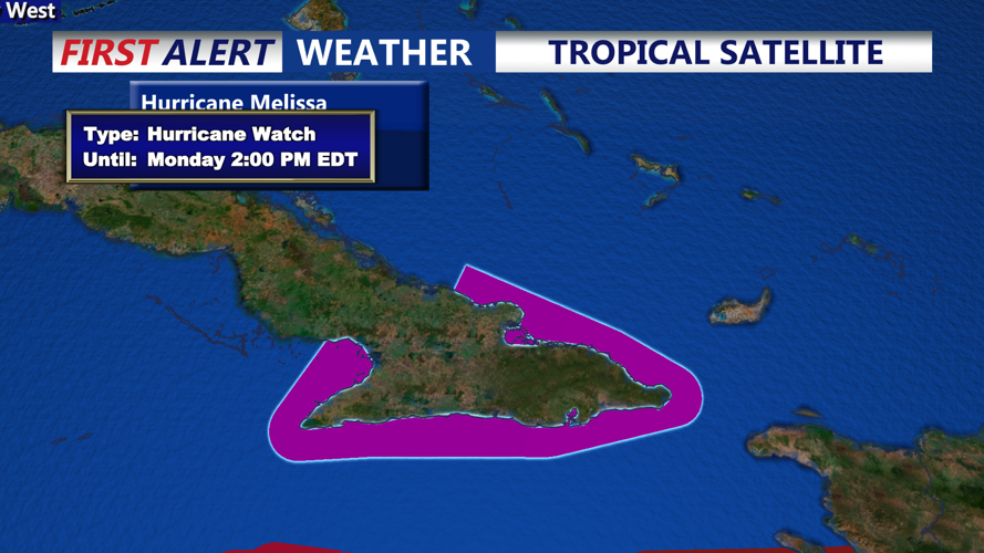
However, there remains a possibility that after traversing the Greater Antilles, Melissa could curve north-northeast under the influence of mid-latitude troughs or the jet stream. If so, the storm could gradually approach the western Atlantic-seaboard corridor mid-next week. Residents and local officials in Sussex County should stay alert to updated NHC tracks and any potential model shifts that could bring indirect effects such as high surf, rip currents or outer-band rainfall.
In short: Jamaica and Haiti are facing a major catastrophe; while Sussex County is not in the direct line right now, it remains prudent to monitor this storm carefully given its strength, slowness and potential for a northward turn.
