




DELMARVA --
After an active 24 hours, Delmarva is not completely out of the woods when it comes to severe weather.
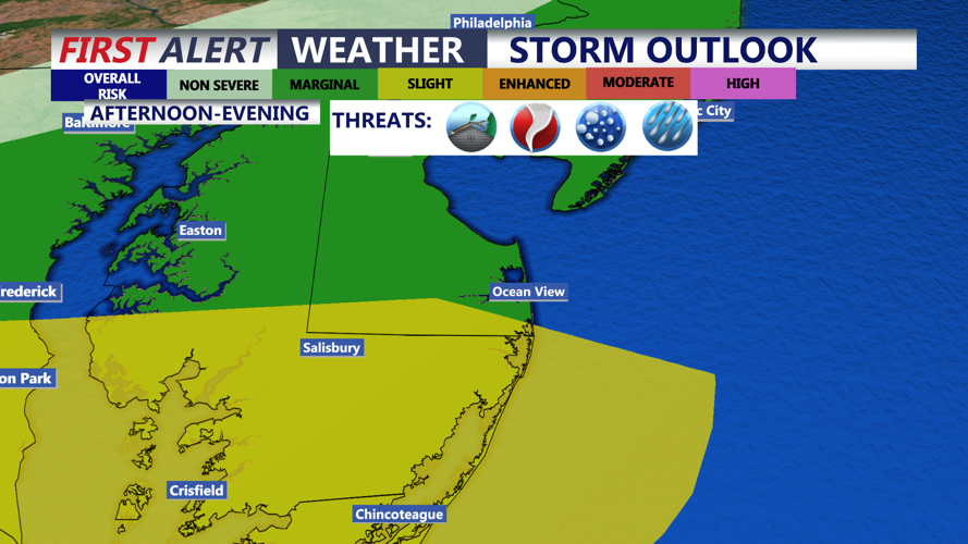
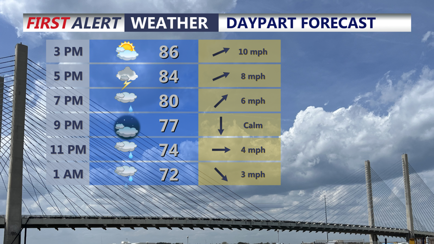
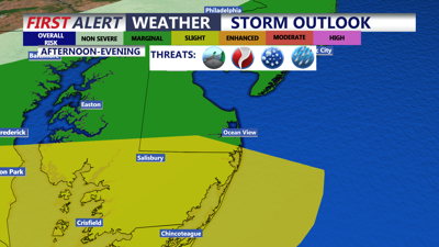
Isolated thunderstorms may redevelop this afternoon through the early evening as a cold front approaches the peninsula. Most locations will not see severe weather, but any stronger storms could produce damaging wind gusts, frequent lightning and heavy rain. An isolated tornado cannot be completely ruled out. Best chance for severe storms would be across southern portions of the peninsula.
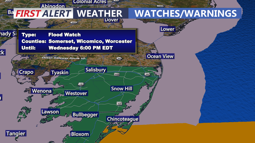
The greatest risk for stronger storms will be across southern Delmarva, where higher instability and stronger wind shear are expected. A Flood Watch remains in effect until 6 p.m. for Wicomico, Worcester, Somerset and Accomack counties. Rainfall totals on the order of half an inch to over and inch. With some locally higher amounts possible.

Flood Watch until 6PM for Wicomico, Worcester, Somerset and Accomack Counties.
Localized flash flooding is possible, especially in communities that received heavy rain during the past day. Storm coverage is expected to be scattered, but slow-moving downpours could quickly overwhelm poor-drainage areas.

Mostly cloudy skies, highs in the mid to upper 80s, more showers and storms possible late afternoon through the evening.
Outside of storms, temperatures will reach the mid- to upper 80s with west-southwest winds from 10 to 15 mph.
A lingering shower or thunderstorm is possible early tonight before skies gradually begin to clear. Overnight lows will fall into the mid- to upper 60s.

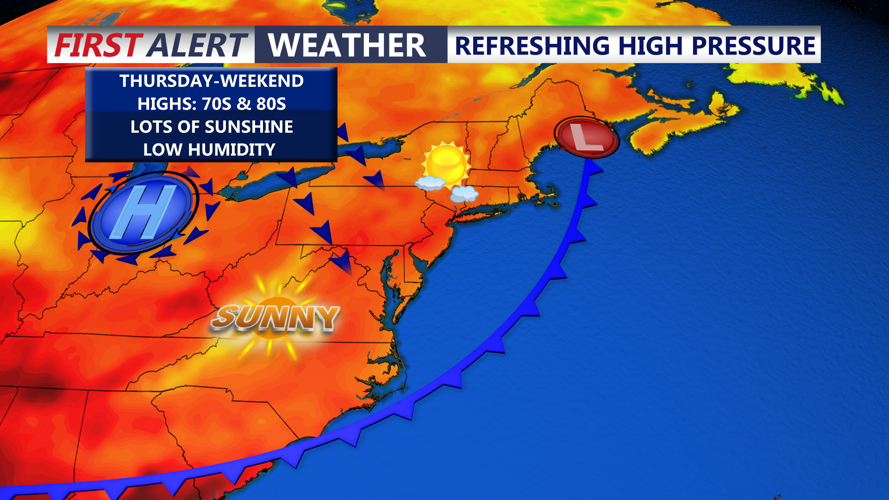
High pressure builds in behind the front, comfortable and sunny conditions through the weekend.
A major change arrives Thursday as drier air spreads across Delmarva. A few clouds may linger early, but skies will become mostly sunny with noticeably lower humidity. Highs will range from the upper 70s to the lower 80s.
The comfortable July weather will continue into the weekend, with mostly dry conditions, low humidity and temperatures in the low to mid-80s as the Delaware State Fair kicks off.
