





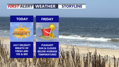
DELMARVA -- A breath of fresh air has arrived across Delmarva, bringing noticeably lower humidity, cooler temperatures and plenty of sunshine beginning Thursday.

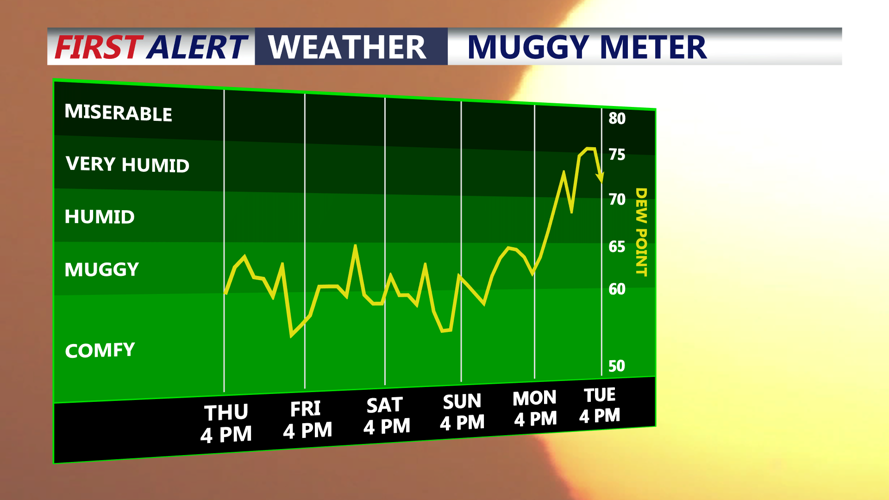
Breath of fresh air, comfortable humidity levels right through the weekend.
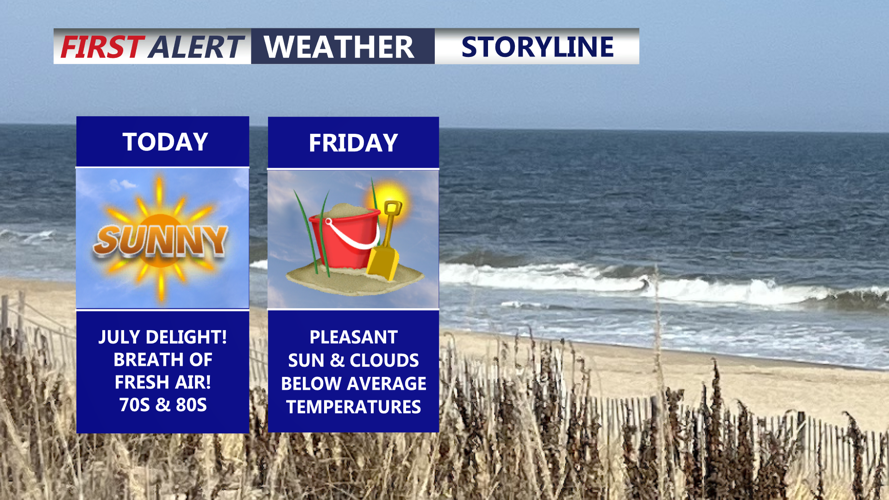
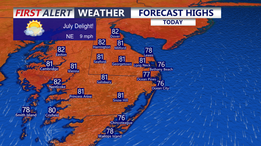
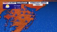
Much drier air moved onto the peninsula from the northwest behind a cold front early Thursday morning. Mostly sunny skies are expected throughout the day, with afternoon temperatures reaching the upper 70s to lower 80s. Northeast winds will remain light at 5 to 10 mph.

A July delight! Mostly sunny skies and highs in the upper 70s to low 80s.
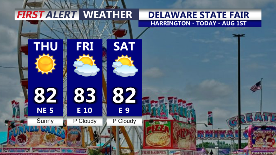
The comfortable weather could not come at a better time for the opening of the Delaware State Fair in Harrington. Fairgoers can expect sunshine, low humidity and temperatures near 80 degrees during the afternoon.

Couldn't ask for a better start to the Delaware State Fair, sunny and comfortable.
Clear skies and unusually comfortable conditions are expected Thursday night. Temperatures will fall into the upper 50s and lower 60s across much of Delmarva.
Friday will bring another pleasant summer day, with partly cloudy skies and temperatures in the upper 70s to lower 80s. High pressure settling across the Mid-Atlantic will maintain the cooler and drier air through the end of the workweek.
Light winds may allow afternoon sea and bay breezes to develop near the coast Thursday and Friday, keeping communities along the Delaware and Maryland beaches slightly cooler than inland areas.
The pleasant conditions will continue into the weekend. Saturday and Sunday are shaping up to be among the best days of the season, with mostly sunny skies, relatively low humidity and afternoon temperatures in the lower to middle 80s.
Changes may begin late Sunday as warmer and more humid air starts returning to Delmarva. A few showers or thunderstorms could approach portions of the peninsula, although the timing and coverage remain uncertain.
The weather is expected to become more active early next week. Temperatures could return to the lower 90s by Tuesday ahead of an approaching cold front.
Increasing moisture and disturbances moving through the upper atmosphere could produce widespread showers and thunderstorms Tuesday into Wednesday. Some storms may bring heavy rainfall, strong winds and localized flooding, but the exact timing and severity will become clearer as the system approaches.
