


DELMARVA - A period of light snow is expected to brush across Sussex County late Tuesday evening into early Wednesday morning, but more serious weather looms ahead. Forecasts only minor snow accumulations tonight; however, an arctic cold front arriving by Friday night is set to plunge the region into dangerously cold conditions.
A weak low-pressure system tracking south of the Delmarva Peninsula is expected to bring light snow to Sussex County after sunset Tuesday and into the early hours of Wednesday. Forecast models indicate limited moisture with this system, meaning snowfall amounts will be minimal—generally around half an inch at most.
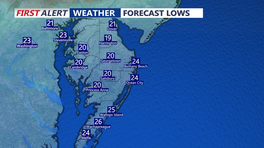
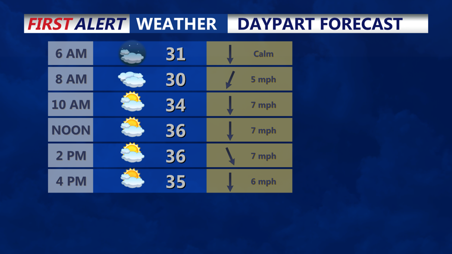
Temperatures will dip into the low to mid-20s overnight, potentially creating slick spots on untreated roads. While impacts are expected to be minimal, residents should exercise caution during the Wednesday morning commute, particularly in areas that receive accumulating snow.
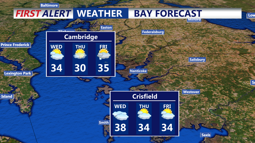
Temperatures will remain below freezing through the middle of the week, with highs struggling to reach the upper 20s to low 30s on Wednesday and Thursday. Overnight lows are forecast to dip into the low teens and single digits in some inland areas. Winds will remain light, which will help limit the wind chill factor temporarily, but conditions will still be notably cold.
The most significant weather hazard will arrive Friday night into the weekend. An arctic cold front is forecast to push through the region Friday evening, accompanied by a quick burst of snow—potentially including snow squalls—and gusty winds.
Snow squalls, though brief, can bring hazardous conditions including reduced visibility, strong wind gusts, and a quick inch or two of snow accumulation. Visibility may drop suddenly, creating treacherous travel conditions Friday night.
Behind the front, temperatures will plummet. Daytime highs on Saturday are forecast in the mid to upper teens, with overnight lows dropping into the single digits or even below zero in some areas. Coupled with winds potentially gusting over 50 mph, wind chill values will plunge well below zero. The National Weather Service warns that this may necessitate cold weather advisories or warnings as early as Friday night, with the most dangerous conditions expected Saturday night and into Sunday morning.
While temperatures are expected to gradually moderate early next week, the cold pattern is forecast to persist through the middle of next week, keeping Sussex County in a deep freeze for several more days.
Residents are urged to prepare for extreme cold, secure outdoor items before Friday night’s wind event, and check on vulnerable neighbors and pets during the coldest periods this weekend.