


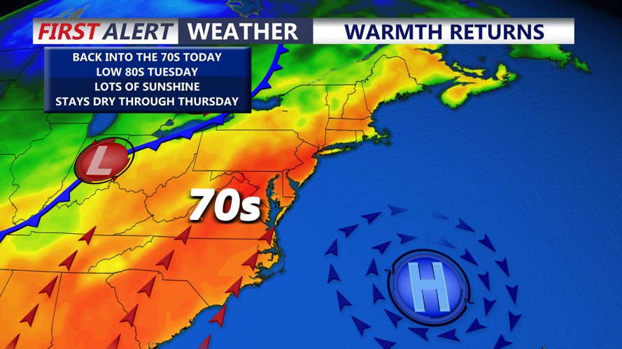

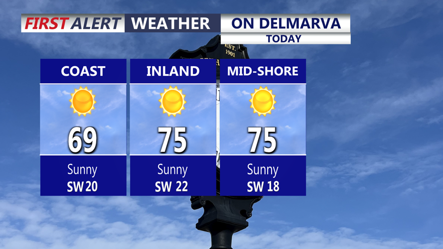
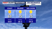
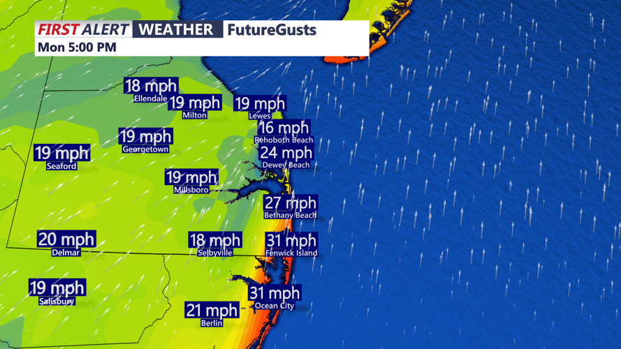


DELMARVA -- After a cool weekend, couldn't ask for a better start to the week. Mostly sunny skies will help temperatures climb into the low to mid 70s inland, while coastal communities stay a bit cooler in the 60s to low 70s. Southwest winds will be noticeable through the day, gusting between 25 and 30 mph.
Elevated risk for fire spread today for all of Delaware, Queen Annes, Talbot and Caroline Counties in Maryland. A combination of dry conditions, relative humidity dropping to 20 to 30 percent, wind gusts 20 -30 mph out of the southwest through the afternoon. Outdoor burning is strongly discouraged. Conditions will improve through the evening.

Mostly sunny skies and highs in the low to mid 70s, upper 60s to low 70s at the coasts.
Tonight will stay mostly clear and breezy, with temperatures falling into the upper 50s to low 60s.

Winds will gust out of the SSW to 25-35 mph, higher gusts into Tuesday.
That mild start will set the stage for a summer-like Tuesday. High pressure centered off the Mid-Atlantic coast will continue sliding offshore, keeping Delmarva mainly dry while southwest winds bring in warmer air. Tuesday will feature mostly sunny skies, breezy conditions, and highs in the low 80s. Wind gusts may reach 30 to 35 mph.
Changes arrive by Wednesday as a cold front approaches from the west and sinks southeast toward the peninsula. Skies will turn partly sunny, with highs in the mid to upper 70s. Scattered showers are expected to break out late in the afternoon as the front moves closer to Delmarva.

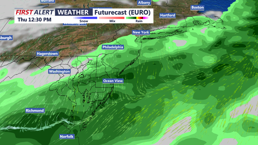
Cold front pushes through late Wednesday, front may stall out over the area Thursday bringing periods of rain.
