


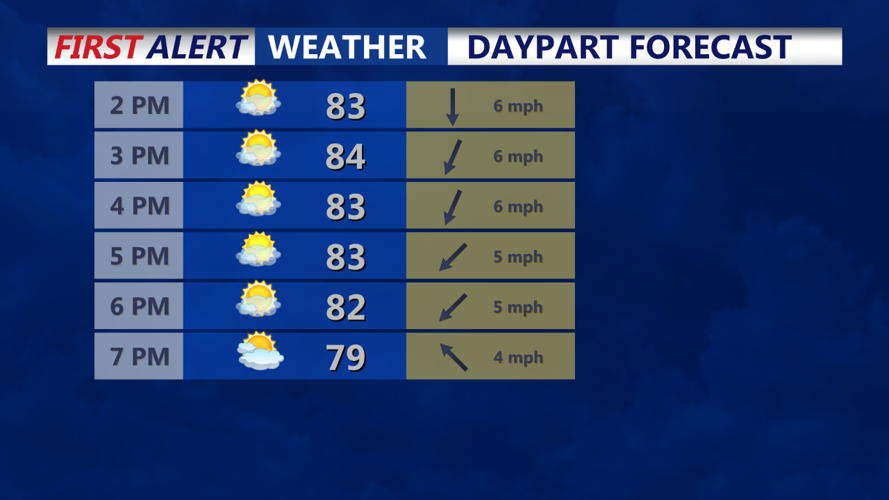

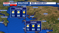

DELMARVA - Wednesday's weather across the region will feature mostly clear to partly cloudy skies, with temperatures rising into the low to mid-80s for most locations. However, cooler conditions will prevail in the Poconos and along the coasts, where highs will only reach the mid to upper 70s.
In the afternoon and evening, some upper-level shortwave energy could move through, potentially triggering a few isolated pop-up showers. While these showers are not expected to be widespread, they shouldn't be ruled out during this time frame.
Looking ahead to Wednesday night through Friday, high pressure will be centered over the Northeast, providing calm conditions as it slides offshore on Thursday. On Thursday, the base of an upper trough over the Mid-Atlantic will begin to break down, allowing zonal flow to develop aloft by Friday.
Thursday afternoon will see sea breezes developing as the surface high remains overhead. These sea breezes could interact with approaching shortwave energy from the west, leading to some isolated showers and thunderstorms, particularly over northern and eastern New Jersey. However, the chance of precipitation remains low, with minimal activity expected.
