





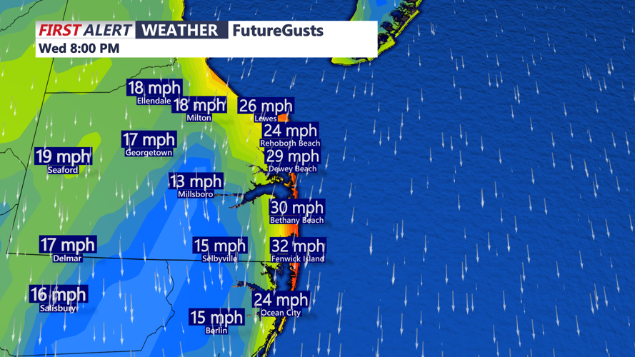



DELMARVA -- The nor'easter continues to wobble some 200 to 300 miles to our east. Some high to mid level clouds will stream into the region especially along the coast through the evening. Otherwise it's a partly to mostly sunny sky with highs in the low to mid 60s. Winds out of the north gust to 30 to 35 mph at the coast, 25 mph inland.

Winds will continue to gust out of the north, highest gusts 30-35 mph at the beaches.
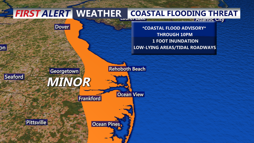
Coastal Flood Advisories remain into effect for Kent and Sussex counties and through the Chesapeake Bay, MINOR tidal flooding up to a foot of inundation is possible through high tide. High surf will continue with wave heights 5 to 11 feet, so minor beach erosion will continue. Winds will shift out of the northwest Thursday and as the coastal low pushes further away wave heights will fall.

MINOR coastal flooding through high tide is possible.
Tonight look for mostly clear skies, chilly night falling into the low to mid 40s inland, upper 40s to low 50s at the beaches.
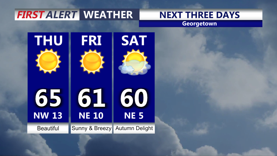
The coastal low will continue to push well out into the Atlantic Thursday and Friday. As far as conditions go Thursday will be beautiful under mostly sunny skies, highs in the mid to upper 60s, winds out of the northwest gusting to 25 mph.

Tons of sunshine, dry conditions continue, breezy Friday, frost growing likely over the weekend.
Spectacular conditions will be with us Friday and into the weekend as a dominant area of high pressure move into the region. Lots of sunshine and highs in the upper 50s to low 60s. In fact we may see frost for a good bit of Delmarva as temperatures fall into the 30s Saturday night, in fact it's possible we could see multiple nights in the 30s away from the beaches.
The dry conditions will continue through at least the middle to the end of next week as temperatures rise back into the low 70s Tuesday. October looks to end on a mostly dry note.
