


DELMARVA -- Happy Easter! A stretch of mostly tranquil weather through early week, followed by a chance of showers and a cool-down heading into the weekend.
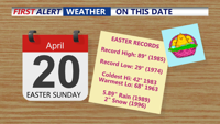
Taking a look at some notable Easter records in Georgetown...

Easter history in Georgetown.
Sunday night, high pressure remains firmly in control, keeping skies mostly clear and winds light out of the north to northeast at 5 to 10 knots. Overnight temperatures will dip into the the upper 40s and low 50s.

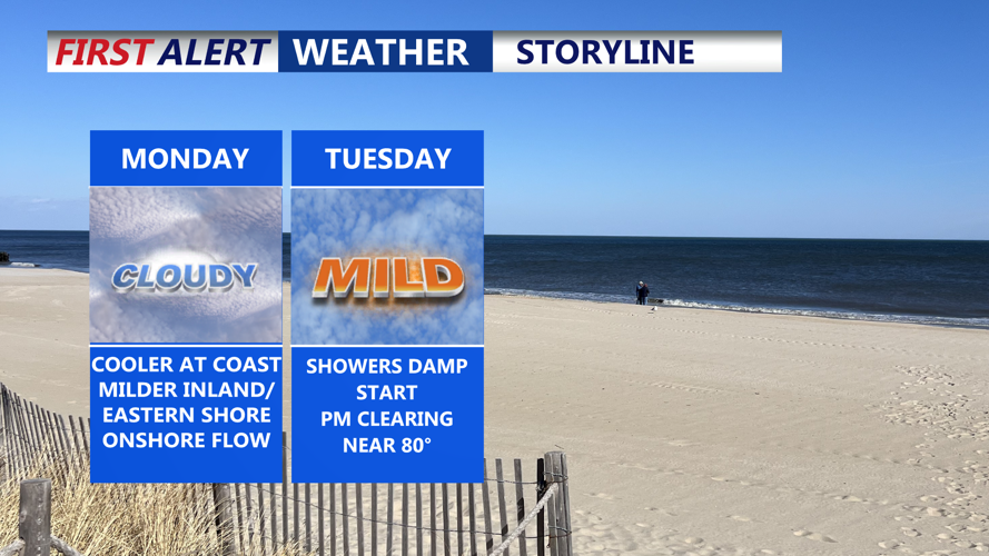
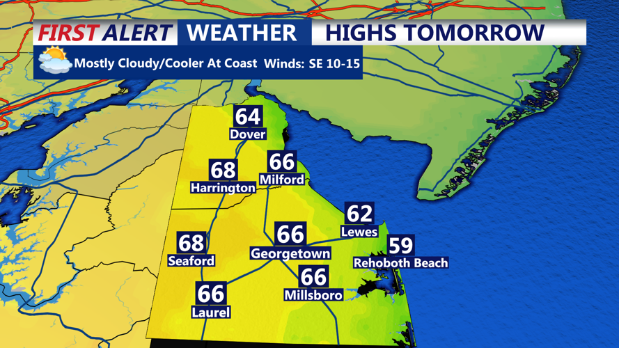
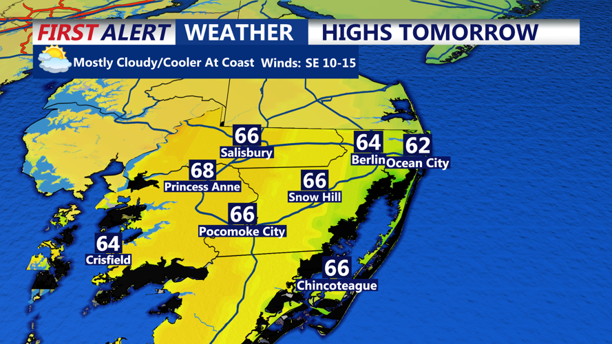
Cooler temperatures at the coast, milder inland.

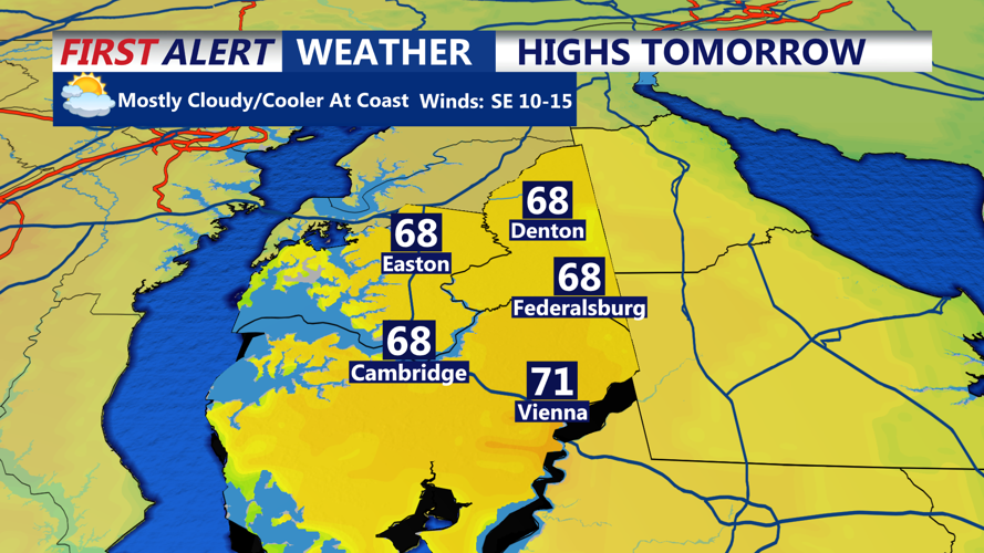
Milder along the Eastern Shore Monday.
Monday begins with high pressure moving offshore and surface winds shifting to the east or southeast. Low clouds will drift across the region during the morning as warmer air arrives, though breaks in the clouds are expected by the afternoon. Delmarva will see highs in the mid-60s under partly sunny skies.

Highs Monday will be in the 60s through much of Southern Delmarva.
By Monday night, a weak cold front approaches from the west, bringing with it a marine layer and a chance of showers, especially in northern parts of the region. Rainfall is expected to be light, with most of the precipitation occurring late Monday night into early Tuesday morning. Lows will range from upper 50s to low 60s.

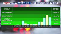
Brief showers into Tuesday morning, mainly dry week until Friday-Saturday.
Once the front passes on Tuesday, skies will begin to clear with a noticeable warm-up, gusty northwest winds. Most of Delmarva will see highs reaching into the 70s, with inland areas potentially touching 80 degrees. Winds will diminish by Tuesday night, and while some mid and high-level clouds may linger, lows will dip into the 50s.
Wednesday brings a return of high pressure and mostly sunny skies. Cooler air will settle in behind the front, keeping highs in the 70s inland and upper 60s along the coast. Light winds and clearer skies are expected overnight, with lows in the 50s across the area.
Thursday continues the dry stretch, though high pressure shifts eastward, setting the stage for a warming trend inland. Highs will range from the mid to upper 70s, while coastal areas may remain a bit cooler due to a southeasterly breeze off the water.
By Friday, another frontal system approaches from the west, increasing the chances of showers and possibly some thunderstorms into Saturday. While confidence in timing remains low, expect the highest chances for rain to occur overnight Friday into Saturday. The presence of a marine layer could limit thunderstorm activity.
Ahead of the front, highs will remain around 70 degrees on Friday and rise into the mid-70s on Saturday. As the front clears the region, cooler and drier conditions are expected to return for Sunday, with highs dropping back into the 60s.