


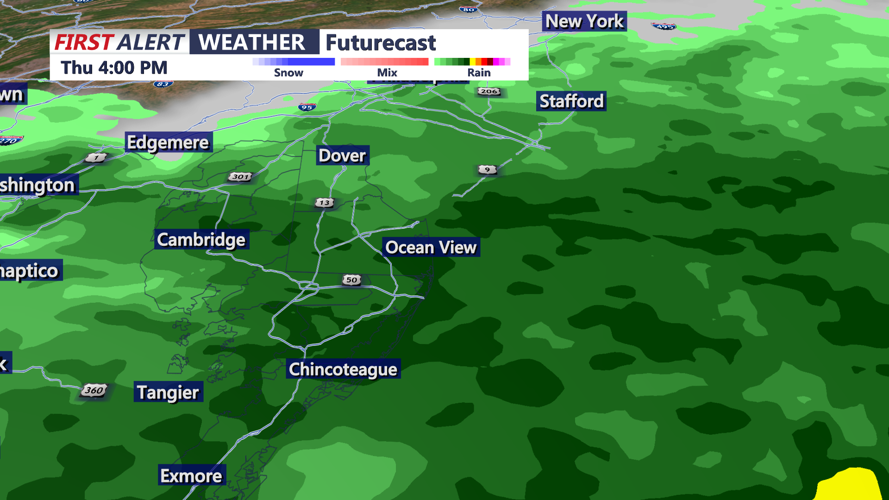
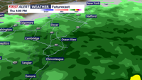

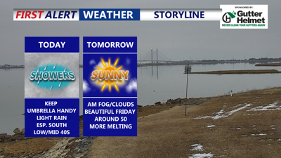
DELMARVA -- Light to moderate rain will push across the Delmarva Peninsula from this afternoon into the evening as low pressure tracks to our south.

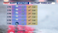
Light to moderate rain will persist through the evening, temperatures in the low to mid 40s.
This is more of a nuisance system than a high-impact storm, with temperatures holding in the mid 40s for most communities. Rainfall will generally be on the lighter side, with totals around 0.15 to 0.35 inches by midnight.

Light to moderate rain into the evening, rainfall will be on the light side, 0.25" with some higher totals further south.
The rain will exit later this evening, and skies will gradually clear overnight. As clearing takes hold, some patchy fog could develop toward Friday morning. Overnight lows drop into the upper 20s to low and mid 30s, so watch for wet spots to refreeze where any standing water lingers.
High pressure takes over Friday, bringing a fantastic day for Delmarva with lots of sunshine and improving conditions. With highs around 50, expect continued snowmelt in areas that still have it.
Saturday looks even milder and is the pick of the weekend: wall-to-wall sunshine and highs near 60. On Sunday, a cold front moves through, but it looks like a dry passage. Temperatures slip back into the upper 40s to low 50s with partly cloudy skies.
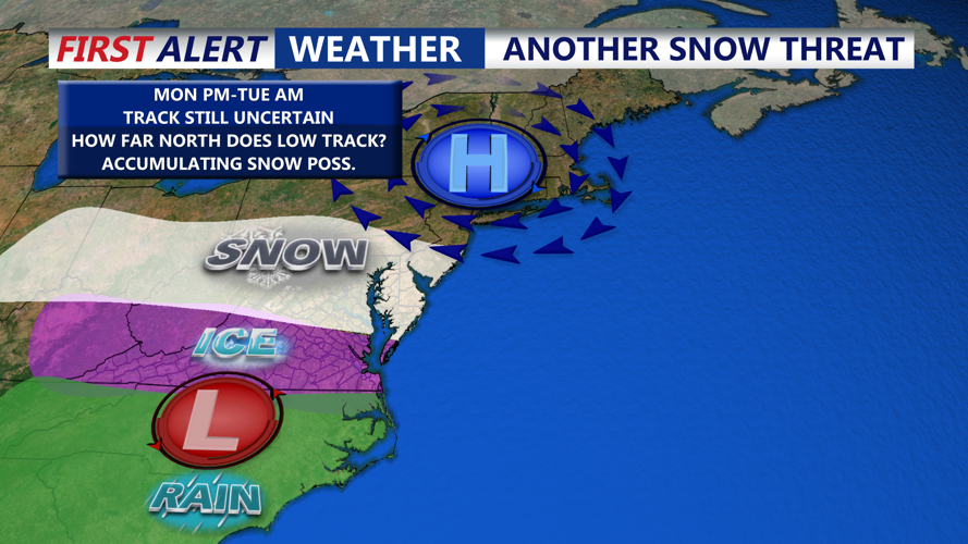
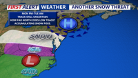
Looking ahead to early next week, uncertainty persists with a developing area of low pressure that may bring another chance of wintry weather. With fresh cold air in place behind an arctic front, wintry precipitation is possible, and we are tracking the potential for accumulating snow Monday night into Tuesday morning.

Arctic air returns briefly Monday ahead of an area of low pressure that could bring a round of accumulating snow Monday.
It’s still too early to lock down exact timing and impacts as forecast guidance continues to vary. Beyond Tuesday, a warm-up is favored by midweek, and any systems during that stretch would most likely bring rain.
