


DELMARVA- While skies turn sunny again this afternoon, temperatures will remain cool for this time of year. Afternoon highs will peak in the 40s to near 50 degrees with continued west-northwest winds around 10–15 mph. The air mass will start to moderate late in the day, but the chill will linger.

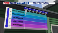
Wednesday night will be mainly clear and cold once again, with lows in the 30s and lower 40s. Be prepared to cover your plants with a frost possible to start the day.
On Thursday, high pressure will slide offshore and winds will begin shifting to the south. This change will usher in a more moisture-laden air mass, with increasing clouds and slightly warmer temperatures in the mid to upper 50s.

Showers increase into Thursday night with lows in the 40s.

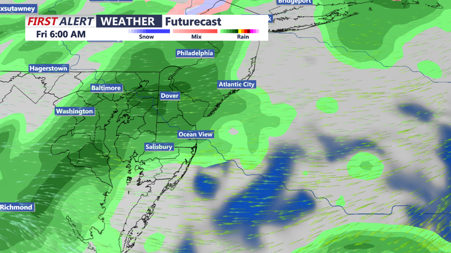
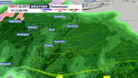
Forecast models suggest a low pressure system could amplify and stall, potentially becoming a nor’easter near the Mid-Atlantic coastline by Saturday morning. If that happens, widespread rain and gusty winds could impact the region Friday through Saturday. Current projections indicate rain chances between 60 percent and 80 percent, with the system likely exiting by Sunday. However, forecast confidence remains low this far out.
