



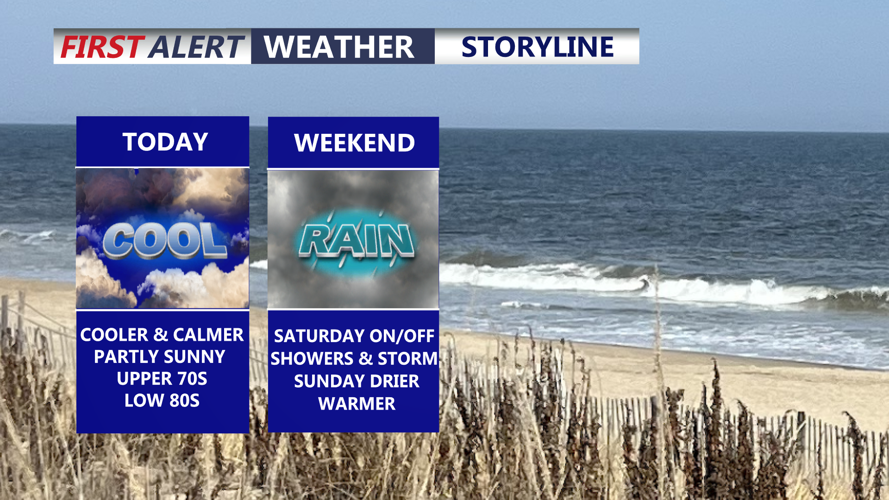
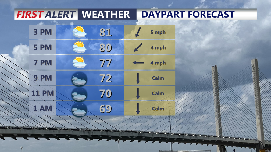

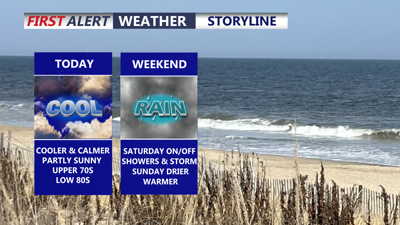
DELMARVA -- Today will provide a welcome break from the stormy weather across Delmarva, with partly sunny skies, lower humidity and comfortable temperatures. Highs will reach the upper 70s to low 80s, with northeast winds of 5 to 15 mph.

Partly sunny skies and highs in the upper 70s to low 80s. Lower humidity levels.
The drier weather will be short-lived. A cold front will stall south of Delmarva tonight while an area of low pressure begins moving northeast along the boundary. Clouds will increase through the evening, followed by scattered showers developing overnight and continuing into Saturday morning. Overnight lows will fall into the upper 60s.
Conditions are expected to become more unsettled Saturday as the area of low pressure approaches from the southwest. Showers will become more widespread, with the greatest concern for heavy rain developing Saturday afternoon and continuing into Saturday night. Highs will be stuck in the 70s for most of the peninsula, with some lower 80s southern portions of the area.
The atmosphere will once again contain plenty of moisture, with precipitable water values approaching 2 inches. Warm cloud layers extending more than 10,000 feet above the ground could allow showers and thunderstorms to become very efficient rainfall producers.

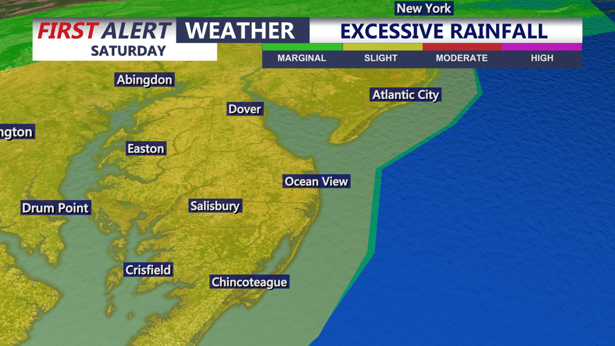
SLIGHT risk (2 of 4) for excessive rainfall Saturday, flash flooding possible with heavier showers and storms that will push through.
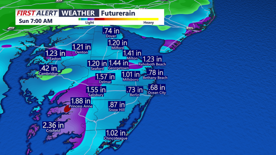
There is still uncertainty over exactly where the heaviest rain will fall. Some forecast guidance indicates localized rainfall totals could exceed 3 inches, although the location of those heavier amounts remains unclear.

Rainfall Saturday through early Sunday morning could be as much as 3" in some localized spots.
The flash flood threat is heightened because much of Delmarva received more than an inch of rain Thursday. Saturated ground means additional heavy rain could quickly produce runoff, flooding of poor-drainage locations and rising water along smaller creeks and streams.
Much of the region is under a Slight Risk for excessive rainfall Saturday, meaning scattered instances of flash flooding are possible. Residents should remain alert to changing conditions Saturday afternoon and evening, particularly in locations that experienced flooding during Thursday’s storms.
The severe thunderstorm threat appears considerably lower than Thursday. Wind shear, instability and atmospheric forcing are all expected to be weaker. An isolated strong or severe thunderstorm cannot be ruled out, but the threat of damaging winds, hail and tornadoes is much lower.
Scattered showers could linger into Sunday as the low-pressure system gradually pulls away. Sunday does look to be the better of the two days this weekend with partly sunny skies and highs back into the mid 80s. Significant weather is not expected throughout the entire day, but unsettled conditions could continue before improving Sunday night.
High pressure is expected to take control early next week, bringing a stretch of dry and tranquil weather Monday through Wednesday with seasonable temperatures. Lot's of sunshine, comfortable highs in the low 80s. Another frontal system may approach Delmarva late next week, but it remains too early to determine what impacts it may bring.
