


DELMARVA -- Expect a pleasant and warm finish to the workweek before unsettled weather arrives over the weekend.

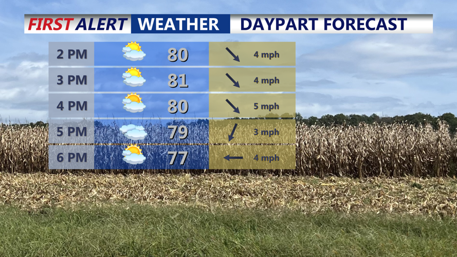
Partly cloudy skies through the afternoon with highs in the upper 70s to low 80s.
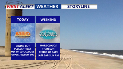
Surface high pressure is building into the Mid-Atlantic from the west Friday, ushering in drier air for Delmarva. Afternoon temperatures are forecast to reach the upper 70s to low 80s under mostly dry conditions and high clouds.
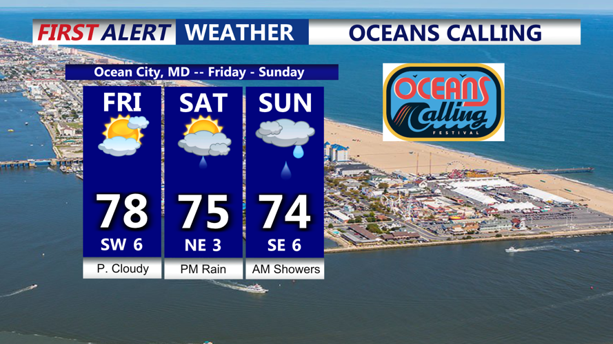
First night of Ocean Calling in Ocean City looks good, dry and pleasant. However the second night not looking so hot, periods of rain expected.

Nice weather for opening night of Oceans Calling, looking for periods of rain late Saturday into early Sunday.
Friday night will feature partly to mostly cloudy skies with calm winds. Overnight lows are expected to dip into the low to mid-60s, limiting any significant overnight cooling.

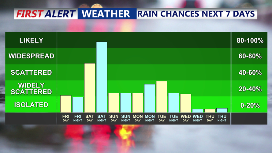
Period of rain late Saturday through early Sunday, then potential tropical moisture moves in early next week.
Heading into Saturday, a weak upper-level trough will remain stalled over the Southeast, leading to a modest increase in southwesterly flow aloft. At the surface, a stationary front will stay draped just south of the region. This setup will favor unsettled conditions across Delmarva, with mostly cloudy skies and periods of rain developing late Saturday and continuing into early Sunday. Modest elevated instability may even trigger an isolated thunderstorm.
Rainfall totals for most areas are expected to remain under half an inch. By Sunday, lingering showers are possible, but conditions are likely to improve Sunday night.
Temperatures will stay seasonable through the weekend, with highs in the mid to upper 70s Saturday and lows in the low to mid-60s Saturday night. Sunday’s highs should generally remain in the mid-70s, with some spots possibly approaching 80 degrees if clouds and showers clear quickly.
Looking ahead to early next week, the long-term pattern remains uncertain due to Hurricane Humberto and another developing system north of the Greater Antilles (Likely Becoming Imelda). Current trends show high pressure keeping both tropical systems south of Delmarva, but rain chances may persist Monday and Tuesday, as some moisture moves into the area. High pressure should settle in midweek, bringing drier and slightly cooler weather by Wednesday and Thursday.
