


DELMARVA - A round of minor coastal flooding tied to Monday night’s high tide cycle has ended along the coast, leaving quieter weather for Delaware’s beach communities early Tuesday through early Wednesday morning.
By the Tuesday morning commute, conditions were expected to improve around Lewes, Rehoboth Beach, Dewey Beach, Bethany Beach and Fenwick Island. Drivers should still use caution in spots where water may have lingered overnight, especially in low-lying areas near the bays and tidal creeks.
Tuesday is forecast to bring a sunny and seasonable beach day, with highs in the mid-70s. North winds at 5 to 10 mph are expected to turn southeast at 10 to 15 mph during the afternoon, bringing a typical onshore breeze along the coast.
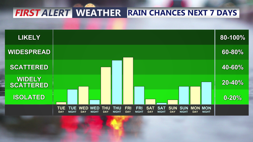
Tuesday night into early Wednesday morning should remain mainly quiet, with partly cloudy skies and lows in the mid-60s. Southeast winds are expected at Tides may remain somewhat elevated into midweek, but water levels are expected to trend lower with each tide cycle. The next change in the weather pattern is expected later Wednesday, when clouds increase and scattered showers become possible.
