


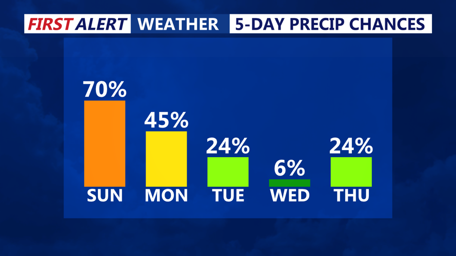


DELMARVA -- A mild but unsettled weather pattern has set in over Delmarva, beginning with Sunday afternoon rain and downpours, ushered in by an approaching cold front. This is just the start of a damp and occasionally stormy stretch that will linger through midweek.

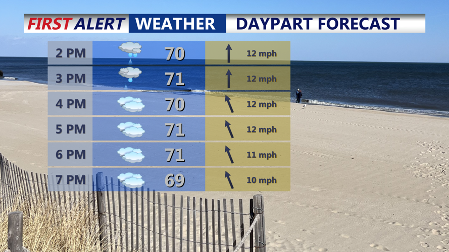
Showers and downpours wind down into Sunday evening.
Rain began spreading across the region Sunday afternoon, fueled by the leading edge of a cold front that will slowly drift south of the area by Monday. Highs on Sunday reached the low to mid-70s for most inland areas, with cooler upper 60s observed along the immediate coastline. By Sunday evening, drier conditions are expected to return, though the sky will remain mostly cloudy and mild overnight with lows holding in the 60s. A few spotty showers or a stray thunderstorm remain possible overnight.
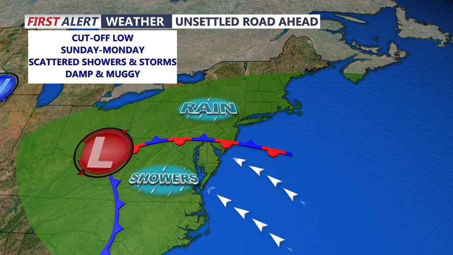
The broader weather story centers on a closed upper-level low that has become nearly stationary over the Ohio Valley. This slow-moving system will send several pieces of energy eastward into the Mid-Atlantic through Tuesday, keeping Delmarva in a pattern of clouds, showers, and occasional thunderstorms.

Cut-off low to our west brings rounds of showers and storms through Tuesday.
Monday brings additional rain chances, especially in the afternoon and evening. While widespread severe weather isn’t expected due to limited instability, southeasterly winds could help trigger a few gusty thunderstorms. High temperatures will climb into the mid to upper 70s inland, with low 70s along the coast.
By Tuesday, some morning showers and isolated storms are possible, but skies are expected to gradually clear by the afternoon. Temperatures will remain on the warmer side, with highs in the mid to upper 70s once again.
A break from the unsettled weather finally arrives Wednesday as the persistent upper low begins to weaken and lift northeast. Mostly sunny skies are forecast with highs in the mid-70s, offering a brief reprieve before the next system approaches.
Another upper-level trough is expected to move into the Northeast late Wednesday into Thursday, pushing a new cold front through the region. This front may bring additional showers or thunderstorms, though forecasters say the exact timing and severity remain uncertain.
The end of the week could feel noticeably cooler. If the upper trough amplifies over the Mid-Atlantic on Friday, it could usher in a much colder air mass aloft, leading to instability-driven showers and possibly even low-topped convection. Some hail cannot be ruled out if conditions align.
By Saturday, the trough should begin lifting out of the region, with high pressure building nearby and more seasonable temperatures returning for Mother's Day.
